OGO at Flims: Meteo and Info Sunday
We have a good day :-)
Meeting point, registration:
At the bottom station at Flims, 10:00
Wetter
*******
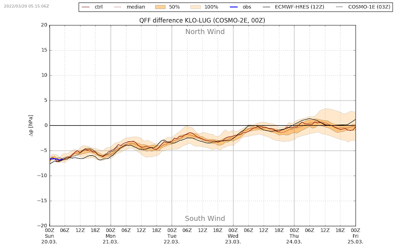
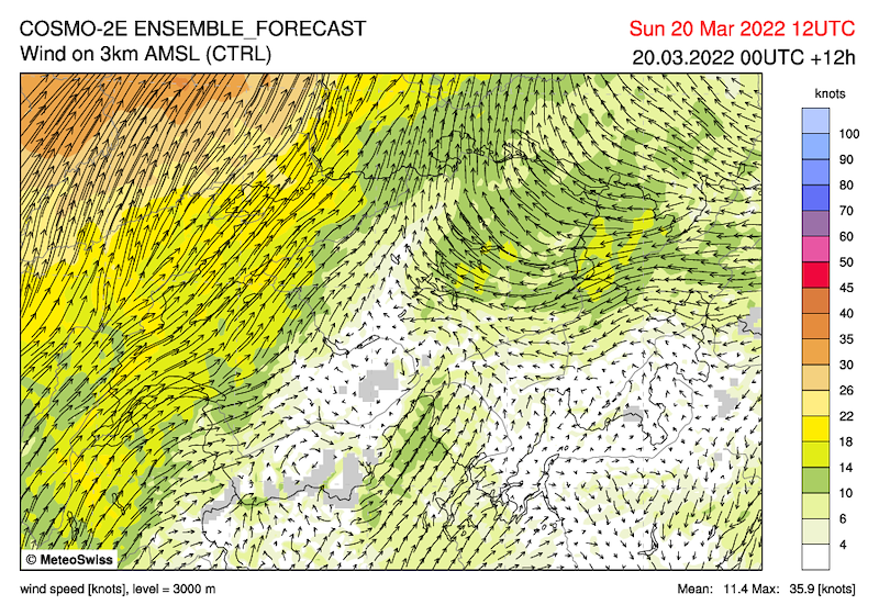
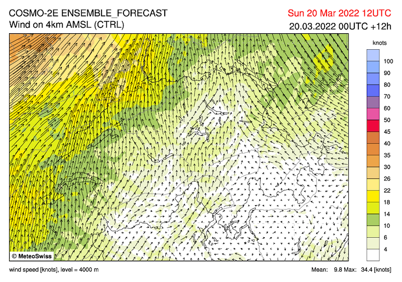
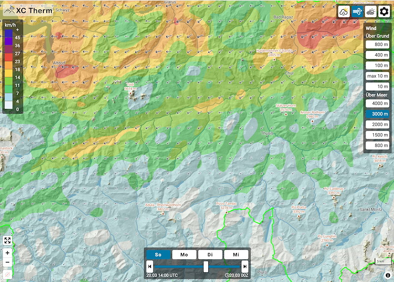
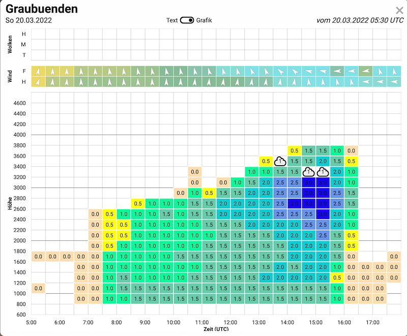
Die hohe Druckdifferenz liegt nur in der untersten Luftschicht. Oberhalb 2500 m kommt der Wind aus Ost. Zudem ist die Druckdifferenz nachlassend. Wahrscheinlich haben wir angenehme Thermik und gute Flugbedingungen. Je später desto besser.
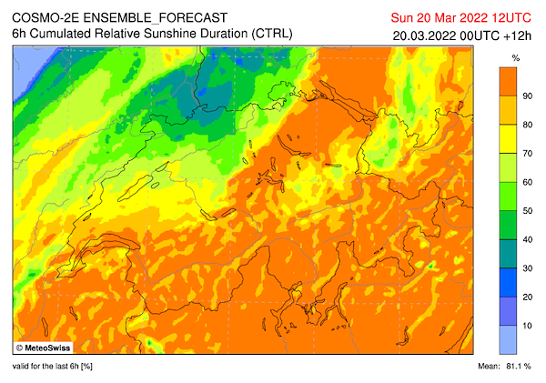
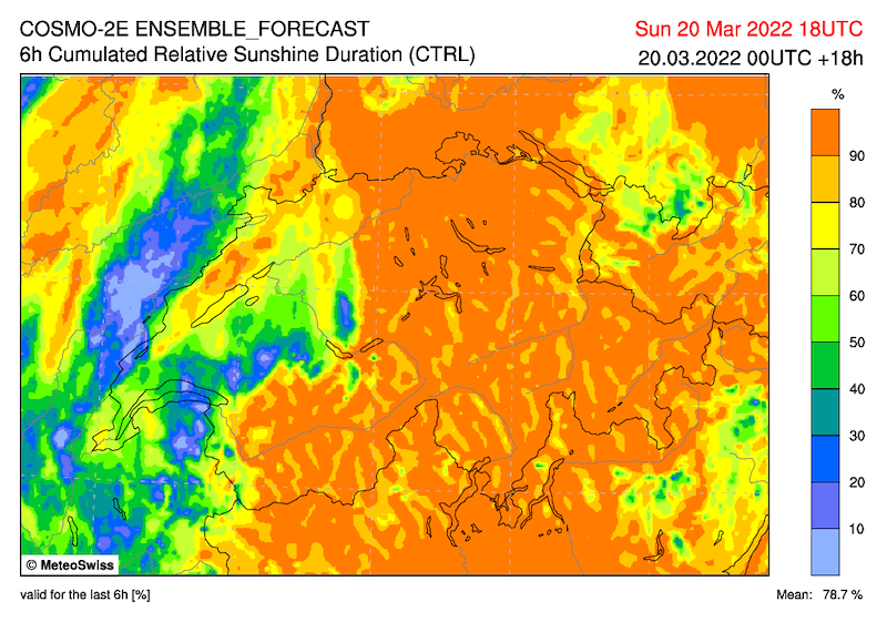
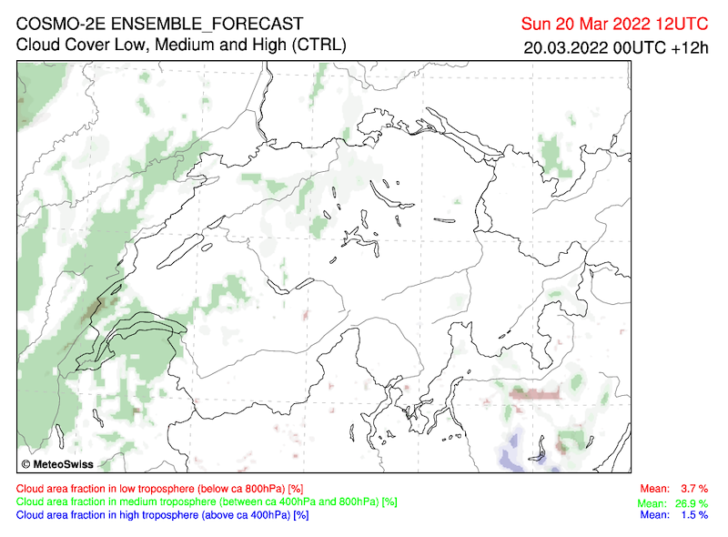
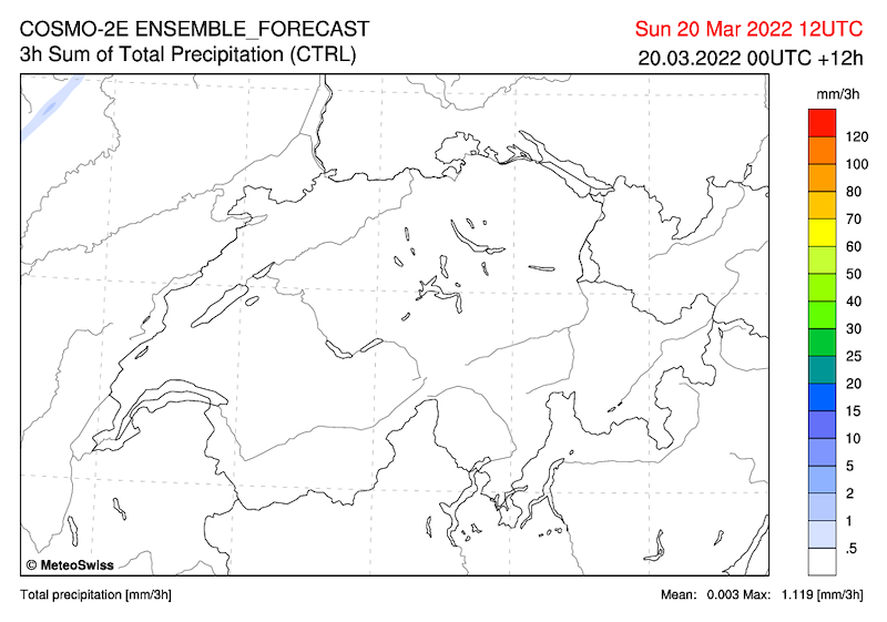
Kein Niederschlag (auch im Süden nicht) und keine oder nur sehr kleine Wolken.
Thermik Top wahrscheinlich 3000m.
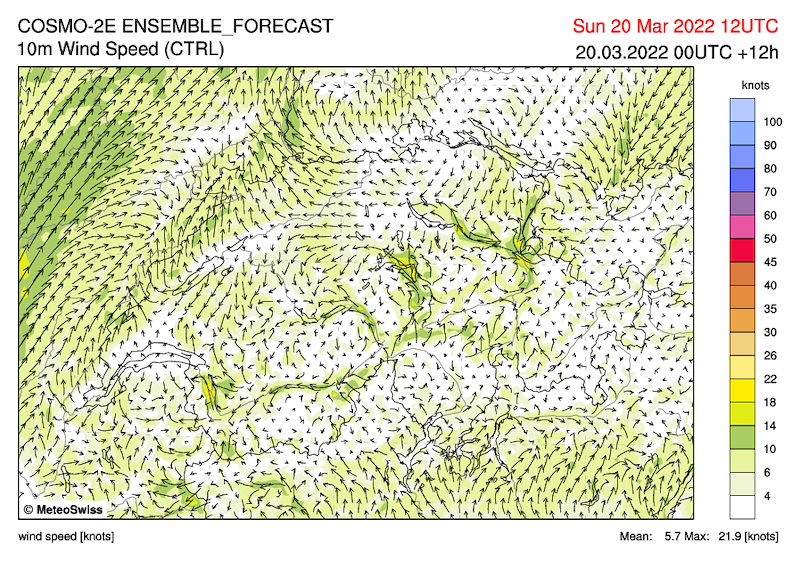
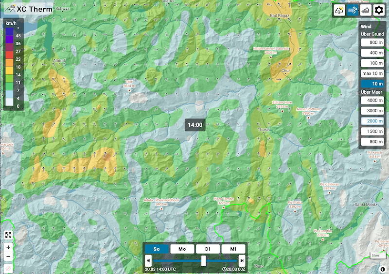
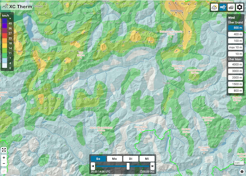
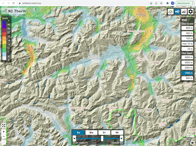
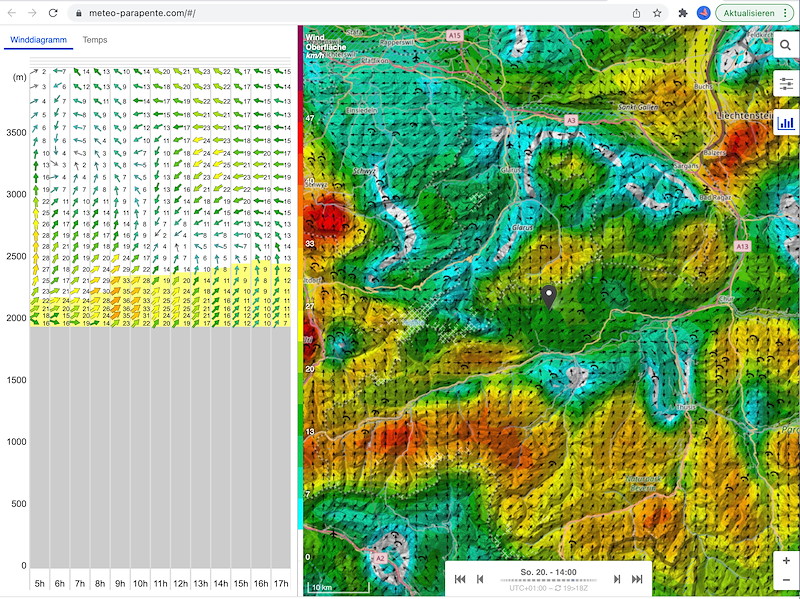
Wind:
- Boden:
- von Disentis bis Trun 20-5kmh aus Westen
- Trun bis Ilanz: 5 kmh West
- Ilanz bis Flims: 10-20 kmh West. Landeplatz in Flims Süd, 5-15 kmh
- Bonaduz-Chur: 35, abnehmend auf 20 aus Süd
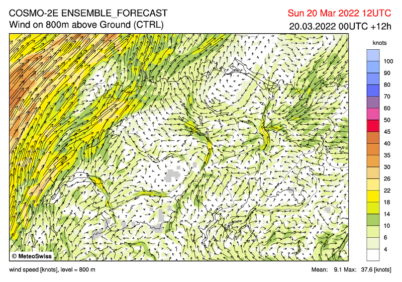
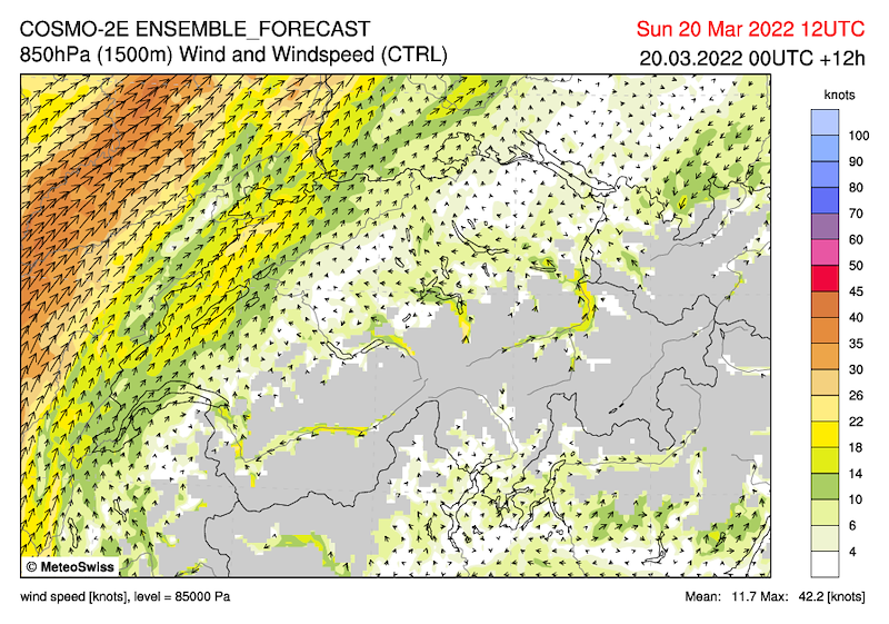
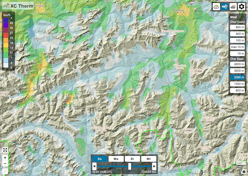
1500-2000m West 15-20 kmh
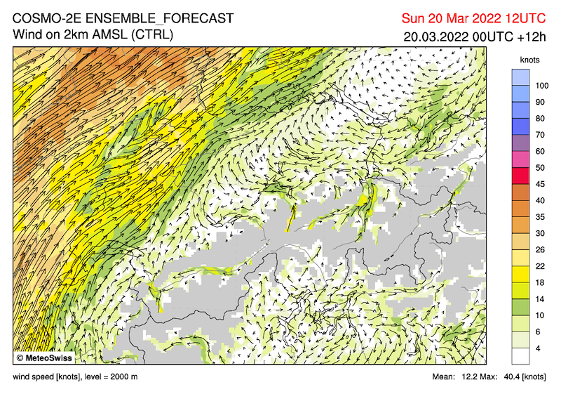
3000m Ost 5 kmh
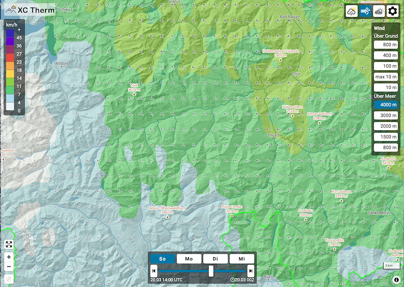
4000m Süd 5 kmh
Zum Föhn:
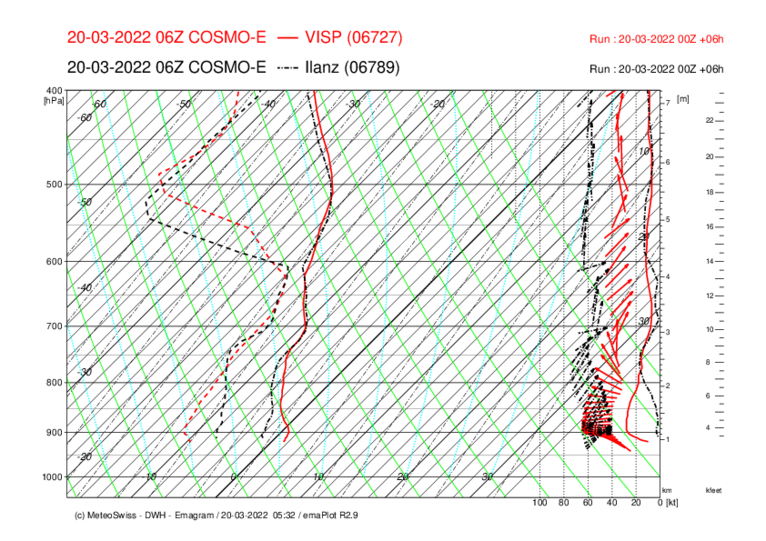
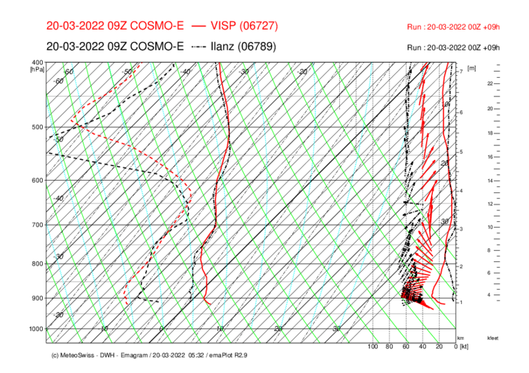
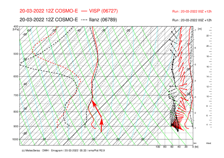
- wir haben einen "seichten" Föhn. Das heisst, dass die Druckdifferenz nur in der unteren Luftschicht besteht. Siehe pdf im Link.
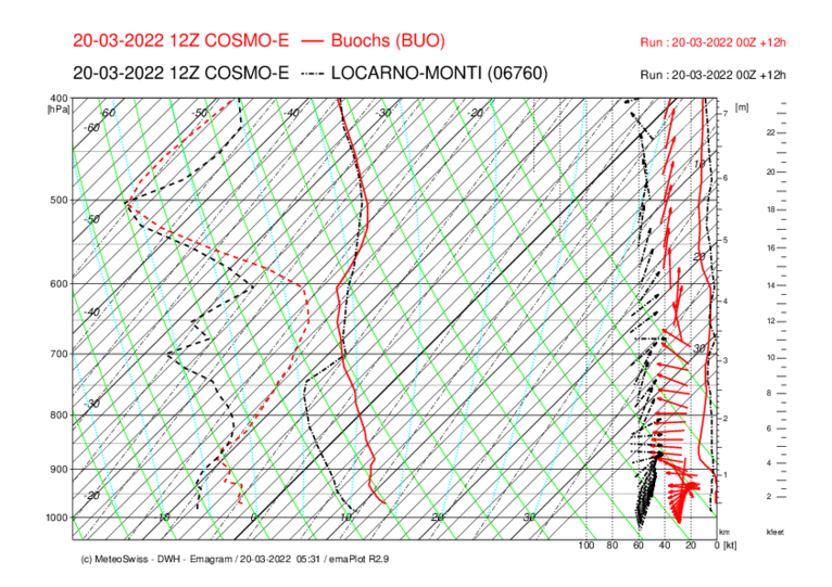
- auf dem Emagramm Buochs-Locarno (letztes Bild) ist gut zu sehen, dass der Temperaturunterschied nur bis 3000m geht. Unsere Alpenpässe sind 2500m hoch - da geht nicht viel Luft von der Süd- auf die Nordseite.
- auf 3000m hat es Ostwind. Es gibt deswegen keine Wellen etc.
- die Druckdifferenz ist nachlassen. Dies ist grundsätzlich ein gutes Zeichen. Zudem könenn wir die Stationen beachten und davon ausgehen, dass es tendenziell besser wir.
- eine sehr aussagekräftige Station ist Crap Masegn
- Hier ist eine Übersicht: https://www.meteo-shv.ch/basic/values/suedostschweiz.html (auch im Link)
Wir haben heute eine spezielle Achtsamkeit auf den Wind. Wir können den Task aber jederzeit stoppen. Und jeder Pilot kann am Funk oder telefonisch den Level mitteilen (Level 1 = gute Verhältnisse, Level 2 = stark aber fliegbar, Level 3 = "ich bin für abbrechen".
************************************
Météo
*******
La différence de pression élevée ne se situe que dans la couche d'air la plus basse. Au-dessus de 2500 mètres, le vent vient de l'est. De plus, la différence de pression diminue. Nous aurons probablement des thermiques agréables et de bonnes conditions de vol. Le plus tard sera le mieux.
Pas de précipitations (même au sud) et pas ou très peu de nuages.
Top des thermiques probablement à 3000m.
Le vent :
- Au sol :
- de Disentis à Trun 20-5kmh de l'ouest
- De Trun à Ilanz : 5 kmh d'ouest.
- D'Ilanz à Flims : 10-20 kmh d'ouest. Atterrissage à Flims sud, 5-15 kmh.
- Bonaduz-Coire : 35, descendant à 20 du sud.
1500-2000m ouest 15-20 kmh
3000m est 5 kmh
4000m sud 5 kmh
A propos du foehn :
- nous avons un fœhn "peu profond". Cela signifie que la différence de pression n'existe que dans la couche d'air inférieure. Voir le pdf dans le lien.
- sur l'émagramme Buochs-Locarno (dernière image), on voit bien que la différence de température ne va que jusqu'à 3000m. Nos cols alpins sont à 2500m - il n'y a pas beaucoup d'air qui passe du côté sud au côté nord.
- A 3000m, il y a un vent d'est. Il n'y a donc pas de vagues, etc.
- La différence de pression diminue. C'est en principe un bon signe. De plus, nous pouvons observer les stations et partir du principe que la tendance est à l'amélioration.
- Une station très significative est Crap Masegn.
- Voici un aperçu : https://www.meteo-shv.ch/basic/values/suedostschweiz.html (également en lien).
Aujourd'hui, nous faisons spécialement attention au vent. Mais nous pouvons arrêter la tâche à tout moment. Et chaque pilote peut communiquer son niveau à la radio ou par téléphone (niveau 1 = bonnes conditions, niveau 2 = fortes mais volables, niveau 3 = "je suis pour l'annulation".
************************************
Weather
*******
The high pressure difference is only in the lowest air layer. Above 2500 m, the wind comes from the east. In addition, the pressure difference is decreasing. We will probably have pleasant thermals and good flying conditions. The later the better.
No precipitation (not even in the south) and no or only very small clouds.
Thermals top probably 3000m.
Wind:
- Ground:
- from Disentis to Trun 20-5kmh from west.
- Trun to Ilanz: 5 kmh west
- Ilanz to Flims: 10-20 kmh west. Landing site in Flims south, 5-15 kmh
- Bonaduz-Chur: 35, decreasing to 20 from south
1500-2000m west 15-20 kmh
3000m east 5 kmh
4000m south 5 kmh
About the foehn:
- we have a "shallow" foehn. This means that the pressure difference only exists in the lower air layer. See pdf in the link.
- On the emagram Buochs-Locarno (last picture) it is easy to see that the temperature difference only goes up to 3000m. Our Alpine passes are 2500m high - not much air goes from the south to the north side.
- At 3000m there is an east wind. That's why there are no waves etc.
- the pressure difference has decreased. This is basically a good sign. In addition, we can observe the stations and assume that it tends to get better.
- A very significant station is Crap Masegn.
- Here is an overview: https://www.meteo-shv.ch/basic/values/suedostschweiz.html (also in the link)
We have a special attention to the wind today. But we can stop the task at any time. And every pilot can tell the level on the radio or by phone (level 1 = good conditions, level 2 = strong but flyable, level 3 = "I'm for stopping".


New Comment