Swiss Open: Info and Meteo for Saturday, Update
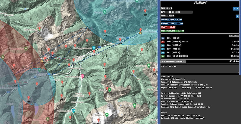
! BRIEFING CAISCHAVEDRA 10:00 !
Take Off 11:00
Airstart 12:00
METEO
Das gestern noch bei uns wetterbestimmende Hoch hat seinen Schwerpunkt etwas ostwaerts verlagert. Die Stroemung dreht auf West bis Suedwest und leitet die Zufuhr warmer, feuchter und labiler Luft zu den Alpen ein.
(Gleitschirmprognose).
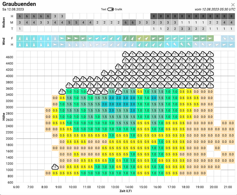
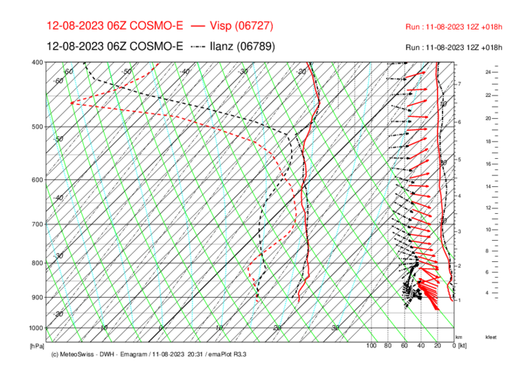
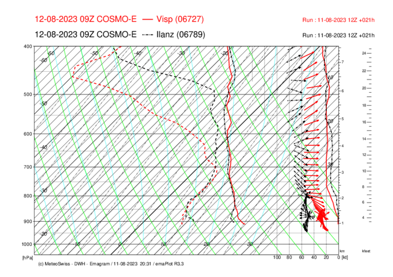
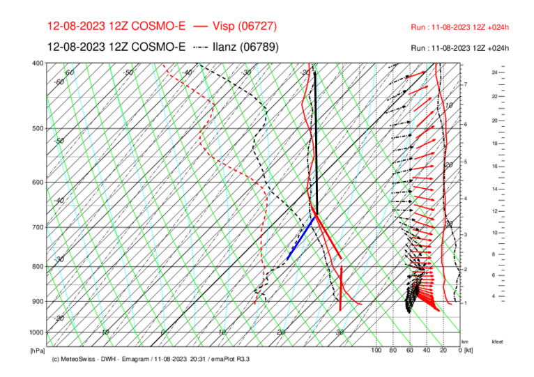
Unsere Region:
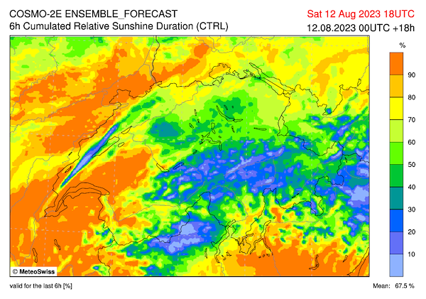
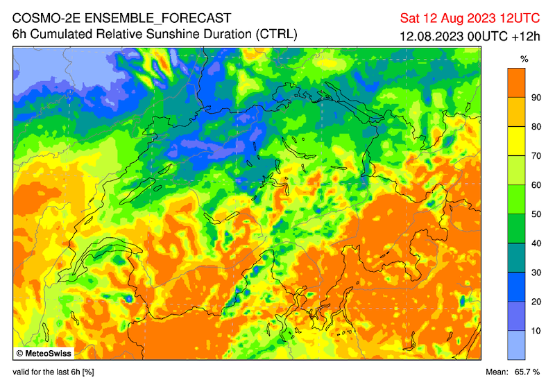
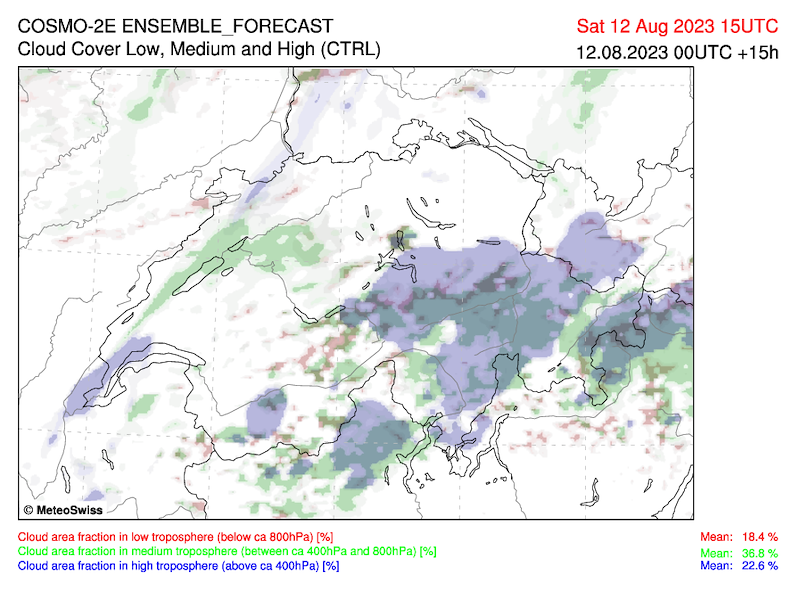
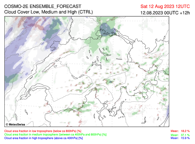
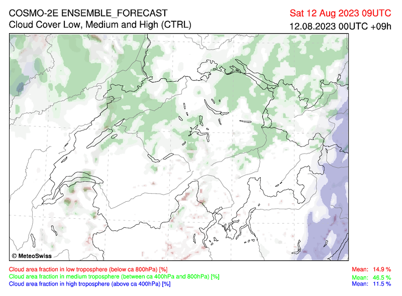
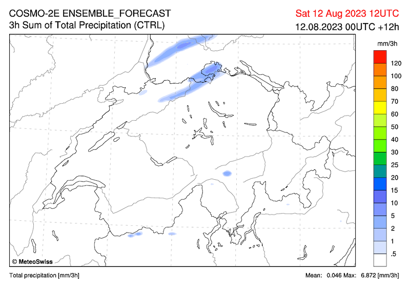
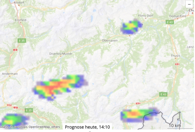
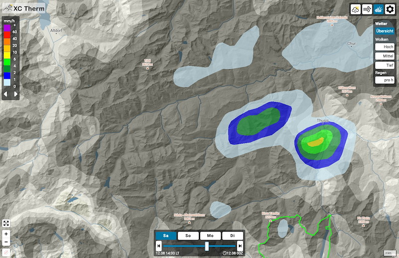
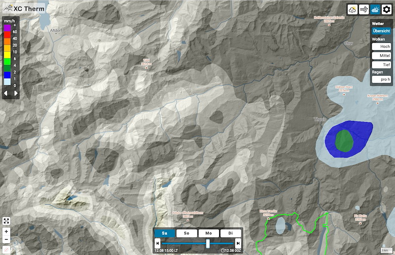
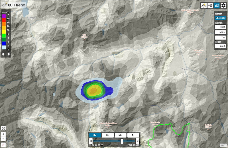
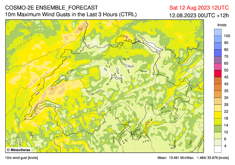
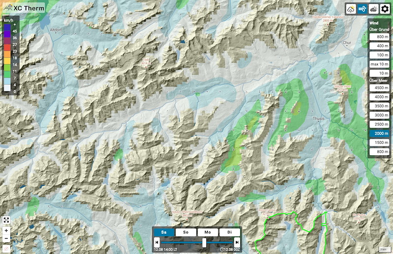
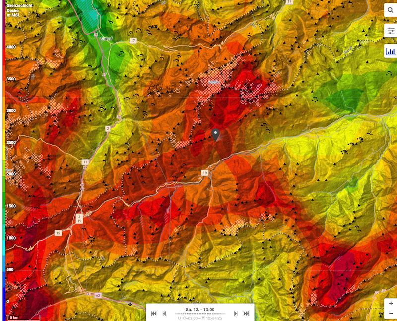
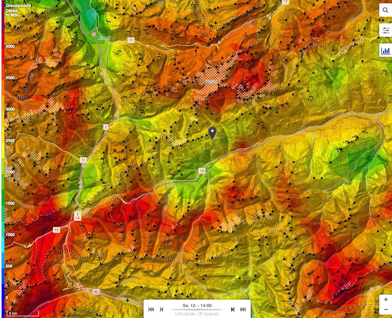
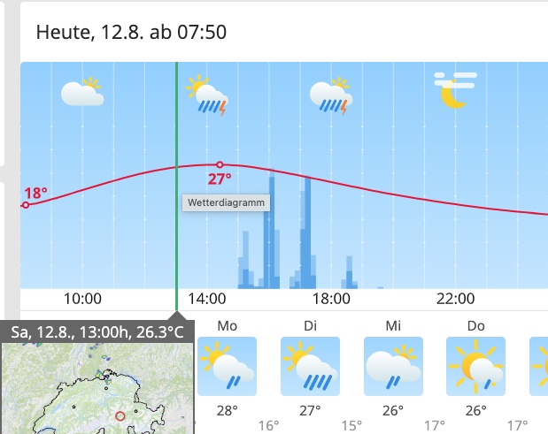
Mittelhohe AC-Wolkenfelder, zunehmend, und nach Thermikausbildung rasch 1-3/8 Cu auf 3200 - 3500, auch Towering Cu. Niederschlag ab 14 Uhr in den Hochalpen (Medel, Terri, aber ev auch Cavistrau).
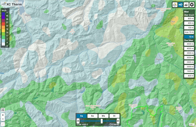
Keine Morgeninversion aber bis 1500/2000 0.4er-Gradient, der durchgeheizt wird und ab Mittag mässige bis gute Thermik.
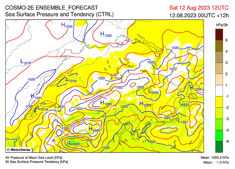
Südüberdruck von 3 auf 0 hp abnehmend, bei ca 1020.
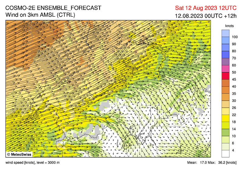
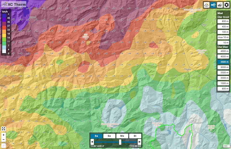
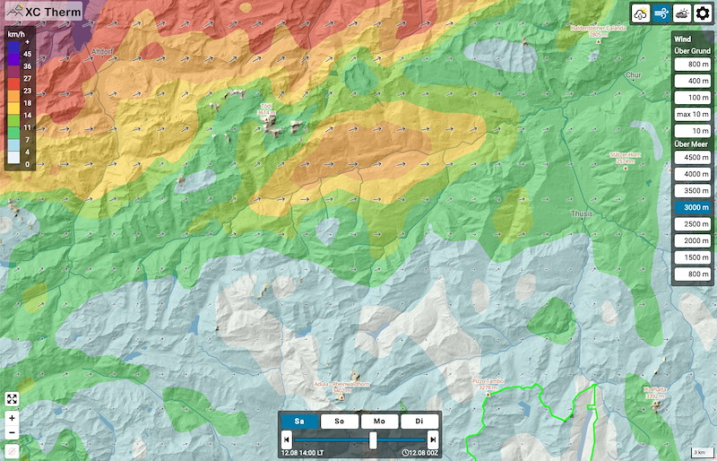
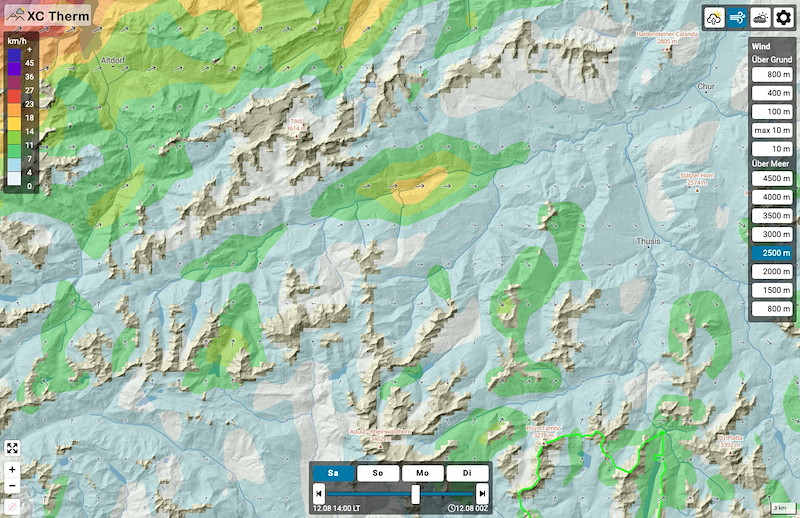
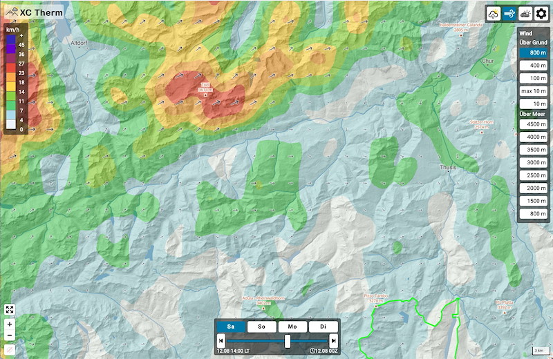
Windprognose 14 h:
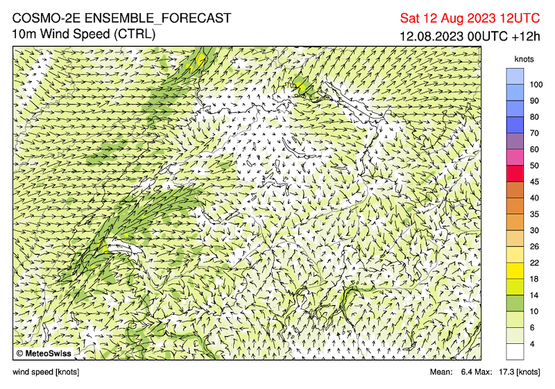
Schwache Talwinde
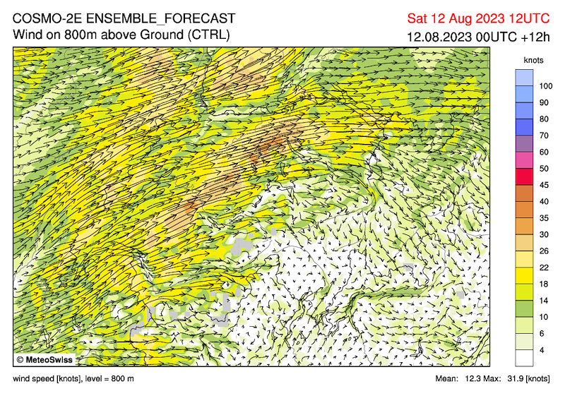
2000m 5 kmh W
2500m 10 kmh W, Lukmanier 15 kmh SW
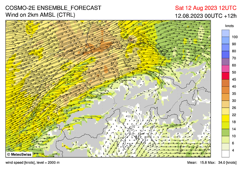
3000m 10-15 kmh NW
3500 m 15-25 kmh W oder SW
4000m 25-35 kmh WSW, Region Nadels ist geschützt
Der Wind wird stark durch die von den Wolken bewegten Luftmassen definiert und wird örtlich stärker sein und aus anderen Richtungen kommen.
Wir versuchen, einen 40 km Task zu machen, Landung in Trun.
*************************************
METEO
The high pressure that was still dominating our weather yesterday has shifted its centre somewhat eastwards. The wind will turn to the west to southwest and initiate the supply of warm, humid and unstable air to the Alps.
(Paraglider forecast).
Our area:
Medium-high AC cloud fields, increasing, and after thermal formation quickly 1-3/8 Cu at 3200 - 3500, also towering Cu. Precipitation from 2 pm in the high Alps (Medel, Terri, but possibly also Cavistrau).
No morning inversion but up to 1500/2000 0.4 gradient, which is heated through and from noon moderate to good thermals.
South overpressure decreasing from 3 to 0 hp, at approx 1020.
Wind forecast 14 h:
Weak valley winds
2000m 5 kmh W
2500m 10 kmh W, Lukmanier 15 kmh SW
3000m 10-15 kmh NW
3500 m 15-25 kmh W or SW
4000m 25-35 kmh WSW, Nadels area is protected
The wind is strongly defined by the air masses moved by the clouds and will be locally stronger and come from other directions.
We will try to do a 40 km task, landing in Trun.


New Comment