Meteo information Monday, and week outlook
Those of us who flew today experienced good thermals early on, with some bumpyness whenever we crossed an inflow on the opposite side of the Rhine valley. The wind turned and became turbulent in Disentis shortly after noon. Landing in Trun was a good option, Ilanz would have worked until after 14:00.
Forecast for Monday, August 3rd
Very similar to today: Slight south over-pressure of 2.5-3 hPa around noon, leading to the "reverse valley breeze" pattern we saw today. The weather will be better to the south, so it should be a little less pronounced.
Winds at altitude from W to SW, at 15-20 km/h.
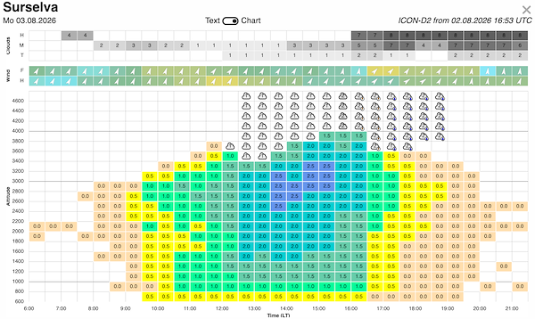
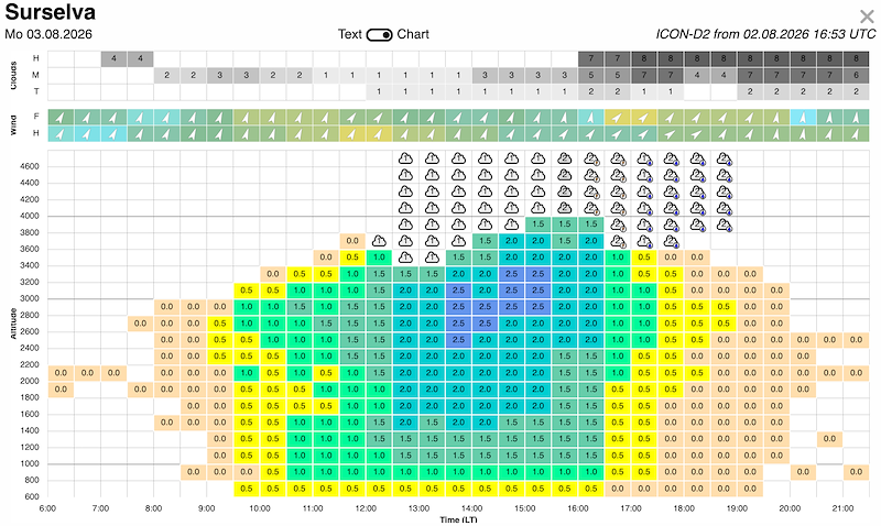
Moderate thermals from early on, assisted by the unstable air coming in. Blue until noon, then Cu at 3000-3200 m, moving up with increasing thermal strength to 3400-3500 m.
A moist layer at 3400 m will slow down convection at first, and delay Cb build-up. First towering Cu are expected around 14:00, with Cb and thunderstorms from 15-16:00
Overall a moderately good which we will do our best to take advantage of. We'll have to be early for that - details at the General Briefing.
Outlook for the rest of the week
Tuesday: An incoming trough increases the risk of thunderstorms, from around 15:00, so another early task could be possible. Strong thunderstorms in the night to Wednesday.
Wednesday: The moisture from the previous night might lead to early over-development and another rained-out day. But with a trough, you never know...
Thursday to Saturday: As the trough moves away, we should see drier days with longer flyable windows, the question is mainly by when this will happen.
Next update: Monday, 08:00









New Comment