SLO: Info and Meteo Monday
Meeting point
9:30 at the same place, north of the cable car station
We stay in the Valley (we do not fly to Zinal)
METEO
*********
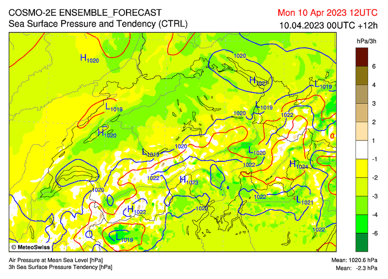
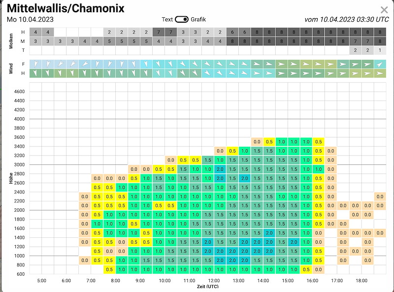
Von einem Tief mit Zentrum noerdlich von Schottland naehert sich eine okkludierende Front, welche am spaeten Abend aus Westen die Schweiz erreicht.
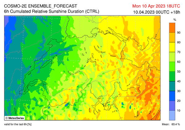
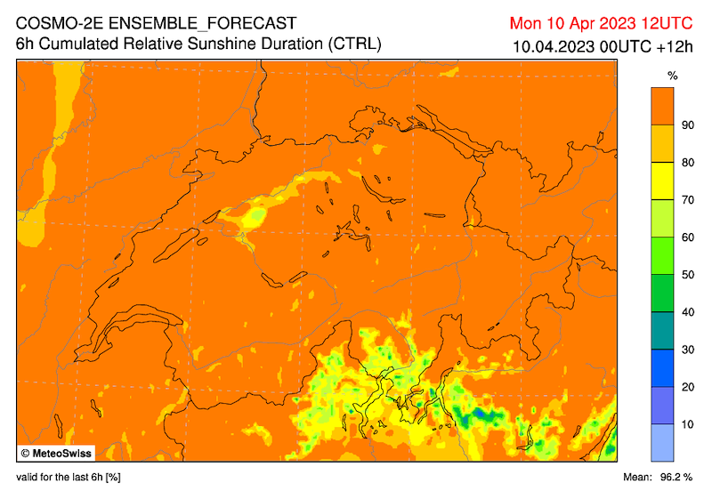
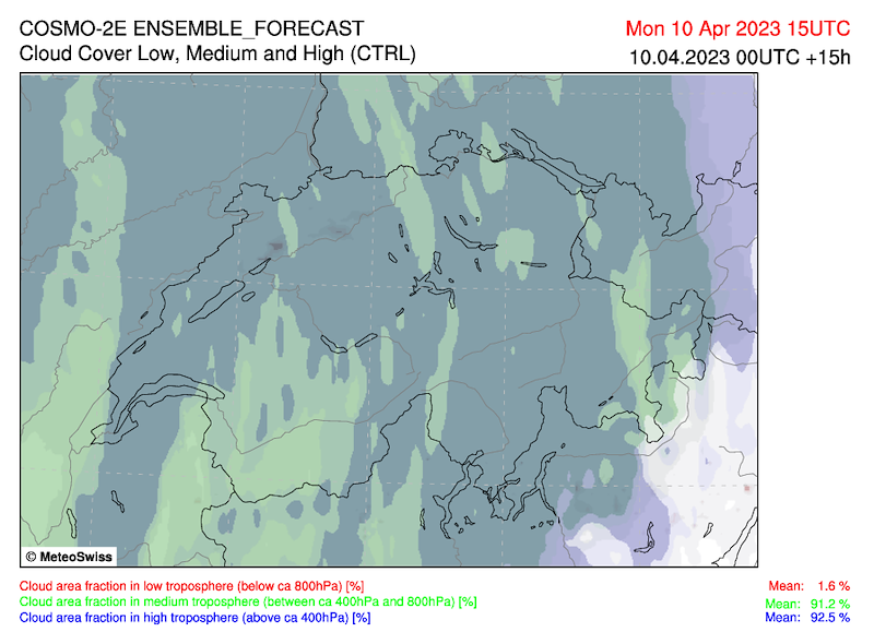
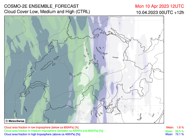
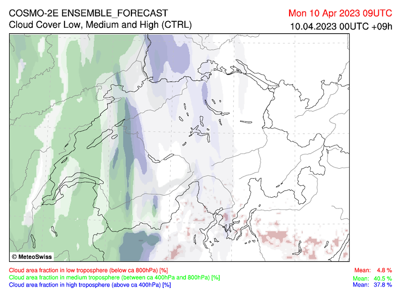
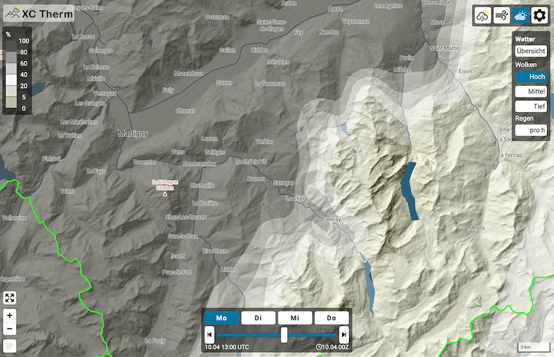
Offizieller Bericht: "6-8/8 dichte mittelhohe und hohe Bewoelkung mit zunehmend absinkender Basis."
Ich glaube Zirren bis 14 Uhr, dann erst absinkende Basis und Verdichtung der Wolken.
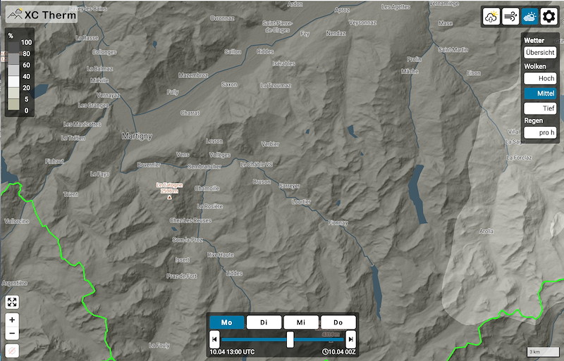
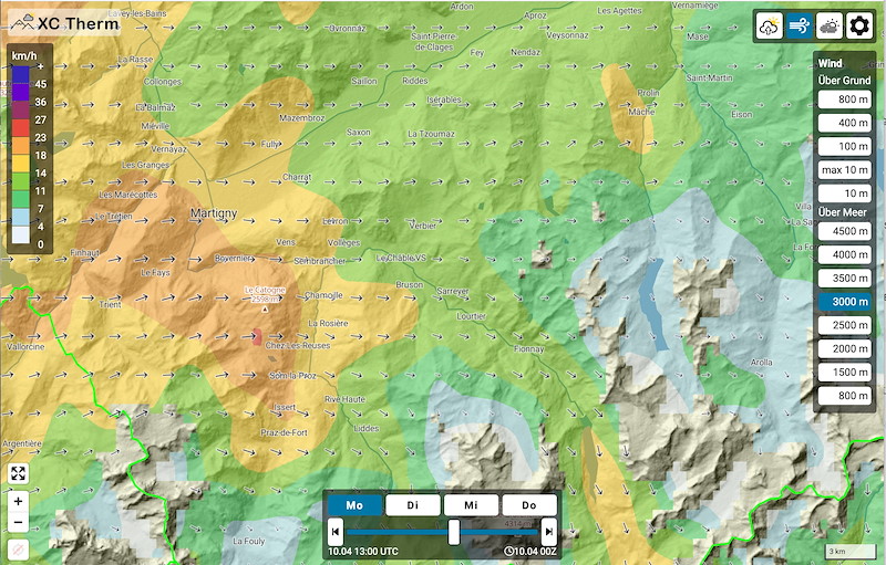
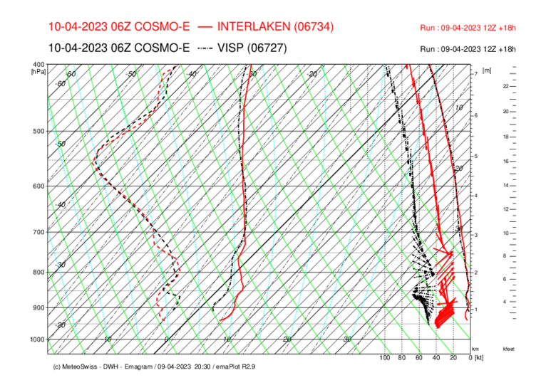
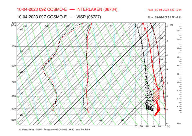
Aufbau zu schwacher Thermik mit Top:
Vorgebirge 2700
Berge 3200
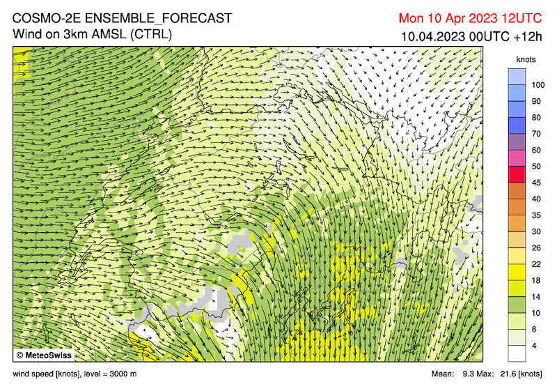
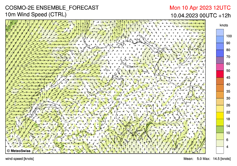
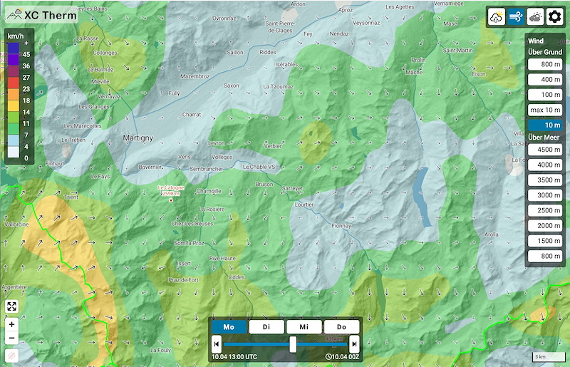
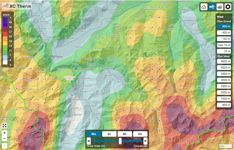
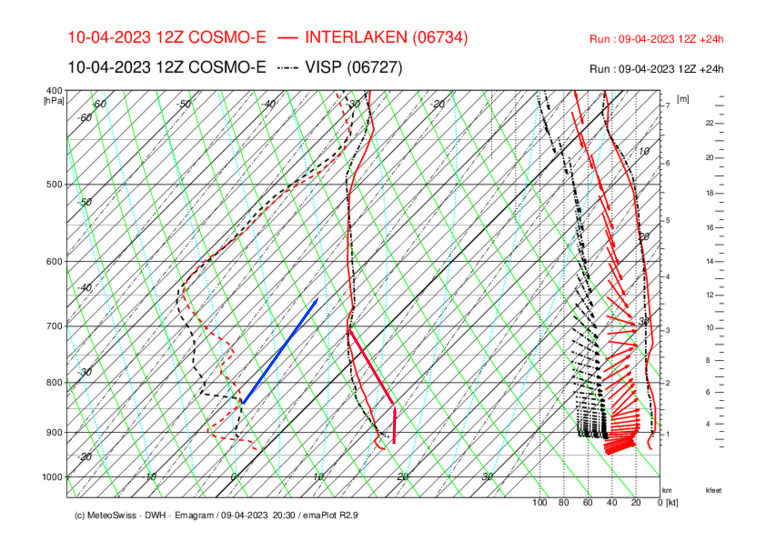
Mässiger Talwind
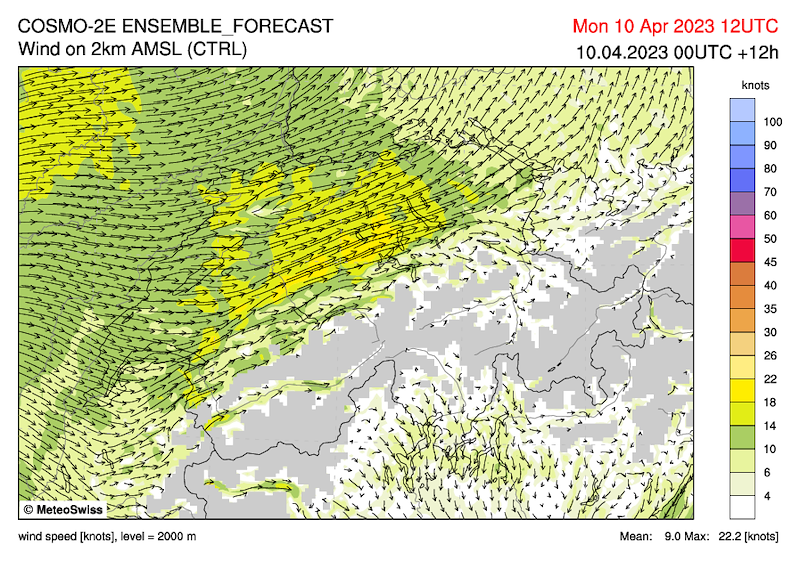
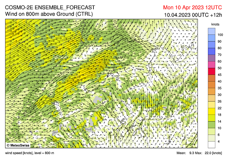
2000m 5 kmh aus westlicher Richtung, geländeabhängig, in unserem Tal zieht er von Norden rein und den Flanken hoch (von West an den Ostflanken)
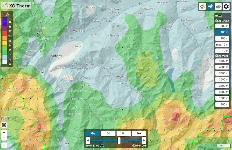
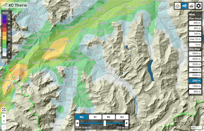
2500m 10 kmh West, aber immer noch vom Gelände gelenkt
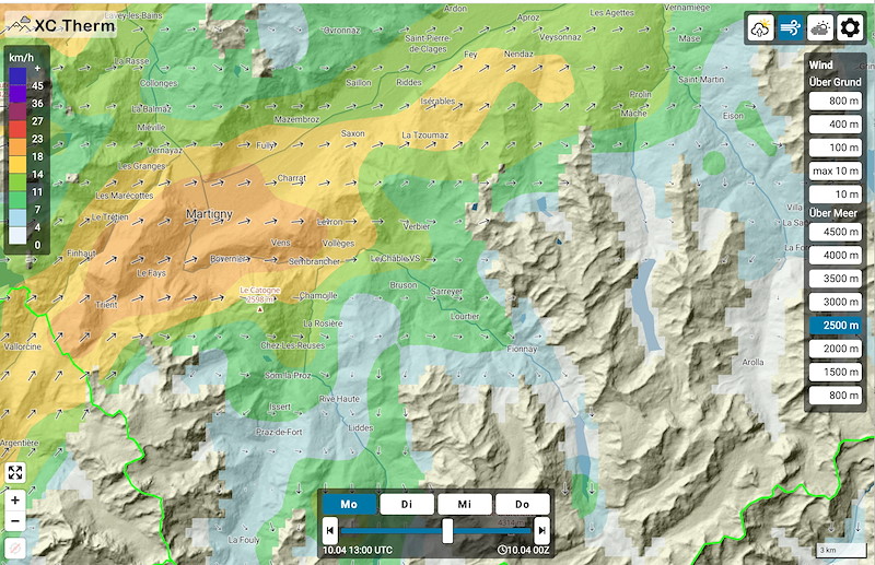
3000m 15-20 kmh Nordwest
Zu beachten der Westwind auf 1000-2000m bei Martigny
*****************
An occluding front approaches from a low with centre north of Scotland, reaching Switzerland from the west late in the evening.
Official report: "6-8/8 dense medium-high and high clouds with increasingly sinking base."
I believe cirrus clouds until 2pm, afterwards only descending base and thickening of clouds.
Building to weak thermals with top:
Foothills 2700
Mountains 3200
Moderate valley wind
2000m 5 kmh from west, depending on terrain, in our valley it pulls in from north and up the flanks (from west on the east flanks)
2500m 10 kmh west, but still steered by the terrain
3000m 15-20 kmh northwest
Note the westerly wind at 1000-2000m near Martigny.
*****************
Un front occlusif se rapproche d'une dépression centrée au nord de l'Ecosse et atteint la Suisse par l'ouest en fin de soirée.
Rapport officiel : "6-8/8, temps dense, moyennement élevé et élevé avec une base de plus en plus descendante".
Je pense qu'il y a des cirrus jusqu'à 14h, puis la base s'abaisse et les nuages se densifient.
Construction de thermiques faibles avec top :
Contreforts 2700
Montagnes 3200
Vent de vallée modéré
2000m 5 kmh d'ouest, en fonction du terrain, dans notre vallée il entre par le nord et remonte les flancs (d'ouest sur les flancs est).
2500m 10 kmh ouest, mais toujours guidé par le terrain
3000m 15-20 kmh nord-ouest
A noter le vent d'ouest à 1000-2000m près de Martigny


New Comment