Swiss Cup: Meteo (SW-Wind)
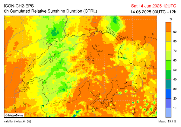
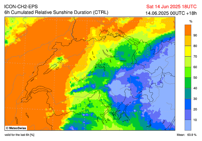
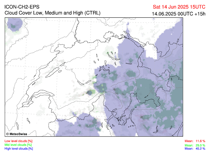
Trotz hoher und mittelhoher Wolkenfelder ziemlich sonnig. Die Gewitterneigung nimmt am Nachmittag in den Bergen zu. Wahrscheinlich besonders entlang des
zentralen- und östlichen Alpennordhangs im Laufe des Nachmittags einige Ueberentwicklungen. Westlich des Gotthards sowie über dem Mittelland und dem Jura wahrscheinlich nur wenige Ueberentwicklungen. Am Sonntag verlagert sich das Tief weiter nördlich und steuert von Westen her eine Kaltfront.
(MeteoSchweiz, SHV-Prognose)
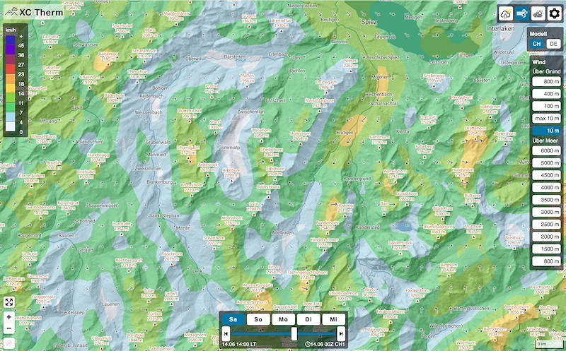
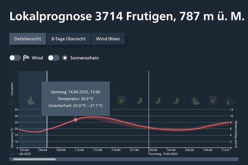
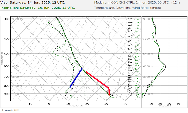
Aufbau zu guter Thermik, 1-3/8 Cu, Basis 3300 m. Bis nach Mittag vorüberziehende Ac/Cirren.
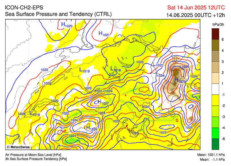
Druck 2021, Druckdifferenz beinahe Null.
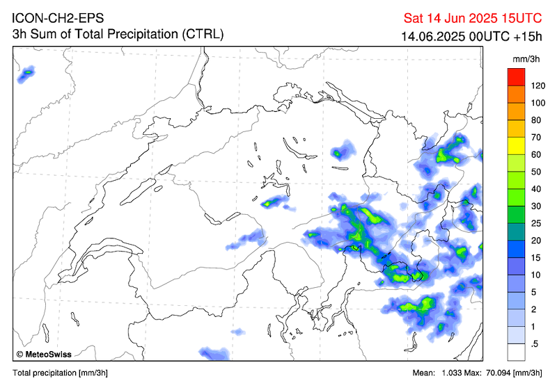
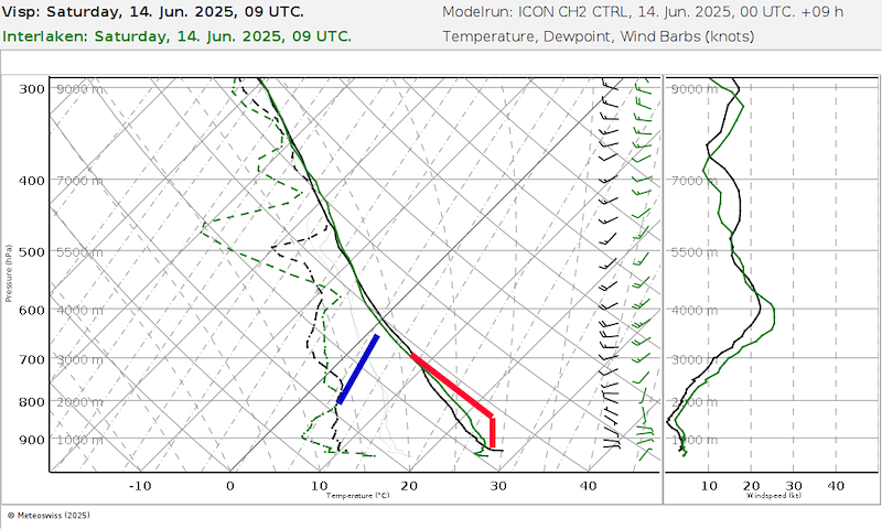
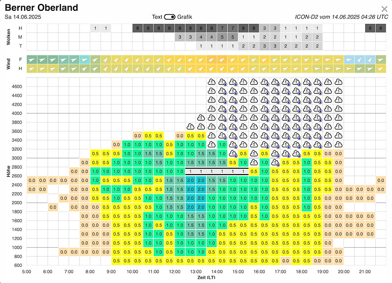
Die Congestus mit Schauern formen sich vor allem am hohen Relief (Kandersteg) und östlich von uns.
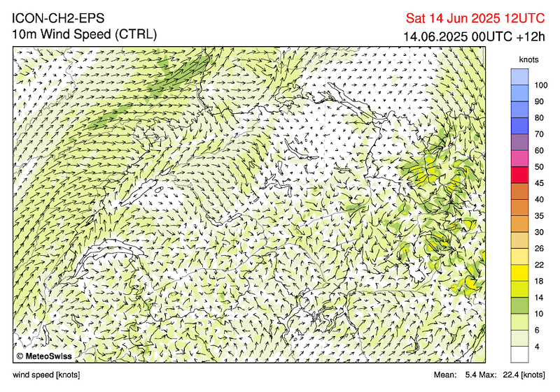
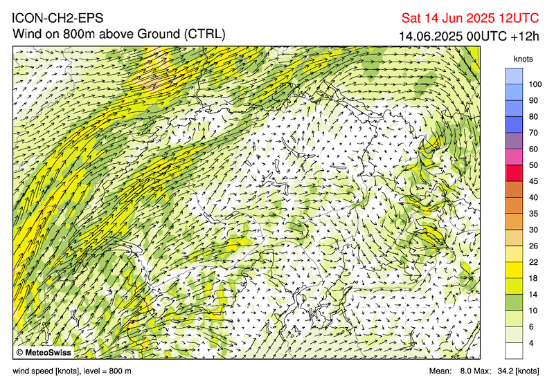
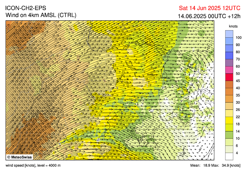
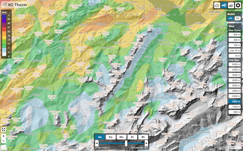
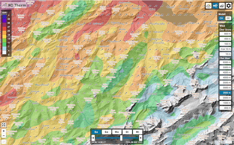
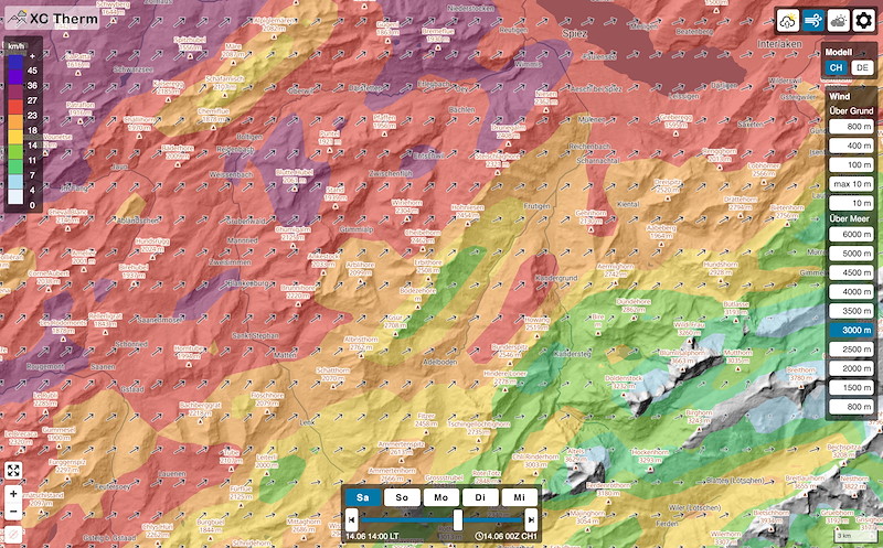
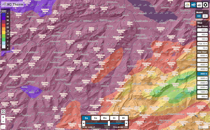
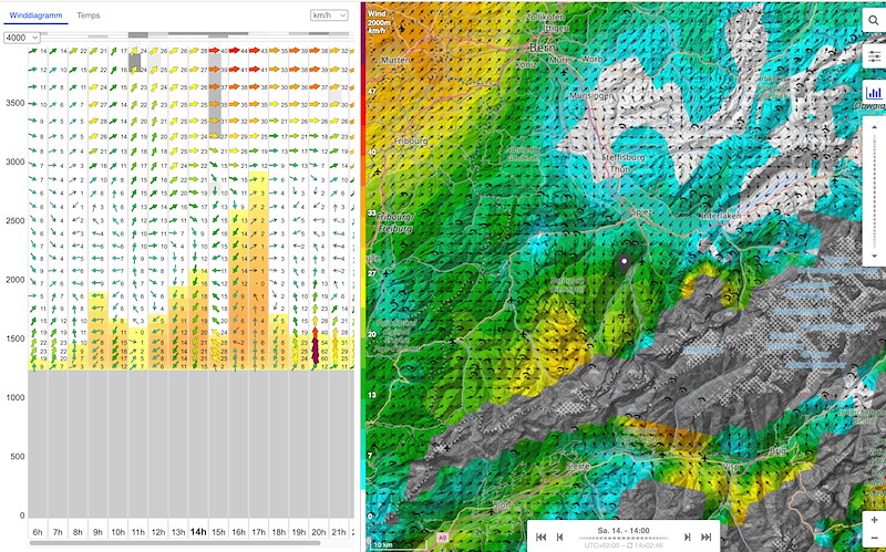
Die Prognose für den Wind hat zugenommen:
Zügige Talwinde (Frutigen wird starken Talwind haben)
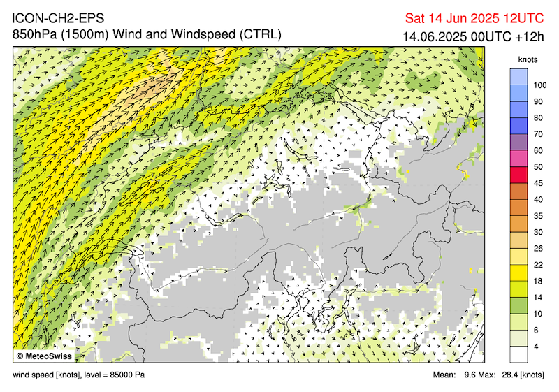
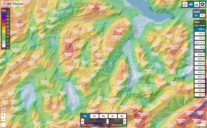
2000m 10-15 SW (je weiter gegen Nord, desto mehr)
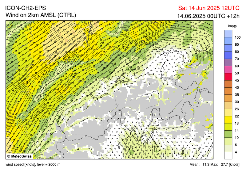
2500m 10-20 SW (je weiter gegen Nord, desto mehr)
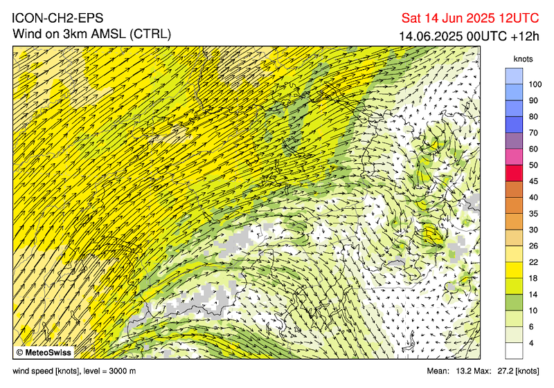
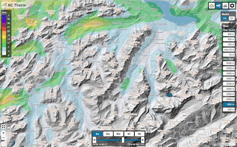
3000m 15-25 SW (je weiter gegen Nord, desto mehr)
4000m 30 SW
Sonntag
Erste Gewitter schon am Morgen und Vormittag nicht ausgeschlossen. Ab Mittag in den Bergen einige, im Flachland einzelne, teils heftige Gewitter- Dazwischen aber weiterhin längere sonnige Phasen. (MeteoSchweiz, Segelflugwetterbericht)
Problematisch ist vor allem auch der SW-Wind. Dieser ist wesentlich stärker als heute.
Wahrscheinlich sagen wir den Sonntag ab. Den Entscheid machen wir am Task Briefing.
***************************
Despite high and medium-high cloud fields, it will be fairly sunny. The likelihood of thunderstorms will increase in the mountains in the afternoon. Some overdevelopments are likely, especially along the central and eastern northern slopes of the Alps in the course of the afternoon. West of the Gotthard Pass and over the Swiss Plateau and the Jura, only a few showers are likely. On Sunday, the low pressure system will move further north and bring a cold front from the west.
(MeteoSwiss, SHV forecast)
Rapid development of good thermals, 1-3/8 Cu, base 3300 m. Ac/Cirrus clouds passing through until midday.
Pressure 2021, pressure difference almost zero.
Congestus clouds with showers are forming mainly on high relief (Kandersteg) and east of us.
The wind forecast has increased:
Rapid valley winds (Frutigen will have strong valley winds)
2000m 10-15 SW (the further north, the stronger)
2500m 10-20 SW (the further north, the stronger)
3000m 15-25 SW (the further north, the stronger)
4000m 30 SW
Sunday
First thunderstorms already in the morning and not ruled out in the morning. From midday onwards, some thunderstorms in the mountains, isolated thunderstorms in the lowlands, some of them heavy, but with longer sunny spells in between. (MeteoSchweiz, gliding weather report)
The SW wind is particularly problematic. It is much stronger than today.
We will probably cancel Sunday. We will make the decision at the task briefing.
************************
Malgré des nuages assez élevés et moyens, le temps est plutôt ensoleillé. L'après-midi, les risques d'orage augmentent en montagne. Quelques développements sont probables au cours de l'après-midi, surtout le long du centre et de l'est du versant nord des Alpes. À l'ouest du Gothard, ainsi que sur le Plateau et le Jura, probablement seulement quelques excès de développement. Dimanche, la dépression se déplace plus au nord et apporte un front froid depuis l'ouest.
(MétéoSuisse, prévisions FSVL)
Développement rapide de bonnes thermiques, 1-3/8 Cu, base 3300 m. Ac/cirrus passant jusqu'à midi.
Pression 2021, différence de pression presque nulle.
Les congestus accompagnés d'averses se forment surtout sur les reliefs élevés (Kandersteg) et à l'est de notre position.
Les prévisions pour le vent se sont renforcées :
Vents de vallée rapides (Frutigen aura des vents de vallée forts)
2000 m 10-15 SW (plus on va vers le nord, plus ça souffle fort)
2500 m 10-20 SW (plus on va vers le nord, plus ça souffle fort)
3000 m 15-25 SW (plus on va vers le nord, plus ça souffle fort)
4000 m 30 SW
Dimanche
Premiers orages possibles dès le matin et en début d'après-midi. À partir de midi, quelques orages dans les montagnes, isolés en plaine, parfois violents, mais avec de longues périodes ensoleillées entre les orages. (MétéoSuisse, bulletin météo pour le vol à voile)
Le vent de sud-ouest est particulièrement problématique. Il est beaucoup plus fort qu'aujourd'hui.
On va probablement annuler dimanche. On prendra la décision lors du briefing de la task.


New Comment