Swiss League Open: Next info Wednesday 20 h
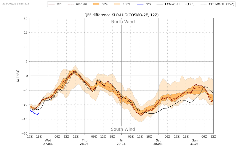
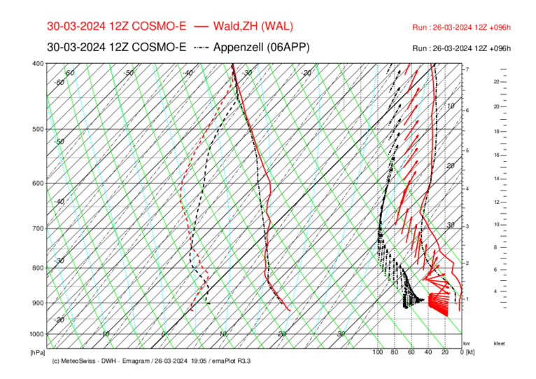
The weather at Easter is difficult. Generally, there will be (sometimes strong) foehn winds with up to 13 hp until Sunday evening, which will exclude many flying areas. We have to take a closer look at the Jura, Interlaken and Alp Scheidegg (Zurich Oberland).
It's Easter and everyone has 4 days off. We are aware of this situation and are leaning towards an early decision, even if it turns out in retrospect that a task would have been possible somewhere. We would also cancel if a moderately good task was possible in Interlaken or the Jura. That means in plain language: Probably tomorrow Wednesday evening we will cancel :-(
Next info Wednesday, 8 pm.
FRIDAY
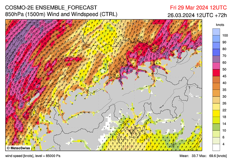
Initially partly dense cloud fields and some precipitation possible, especially in the far north. Otherwise with high cloud fields probably quite sunny. On the main Alpine ridge, clouds and precipitation from the south. Strong to stormy foehn in the Alps.
We see no chance of a task.
SATURDAY
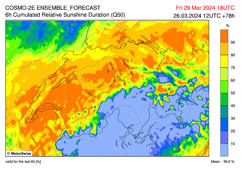
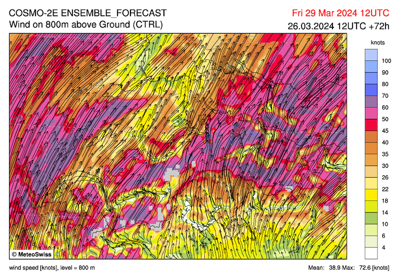
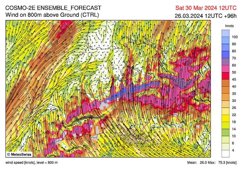
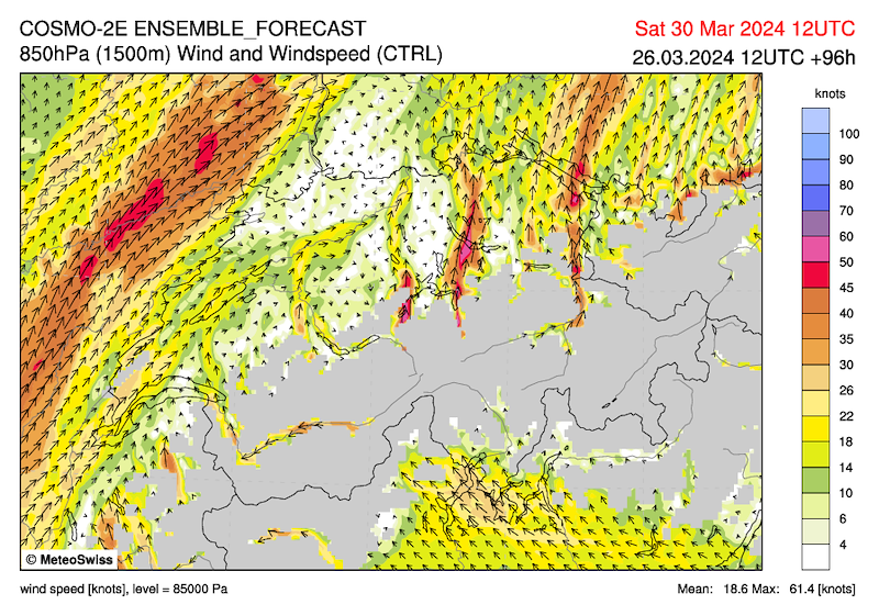
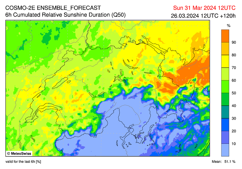
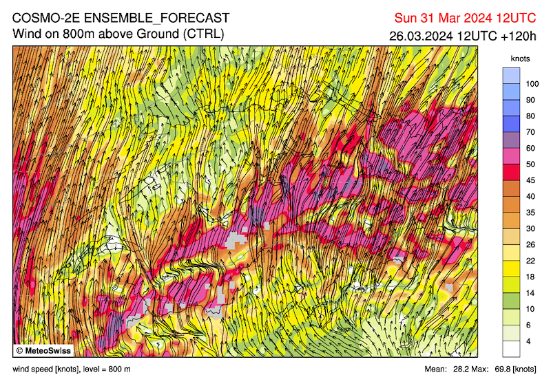
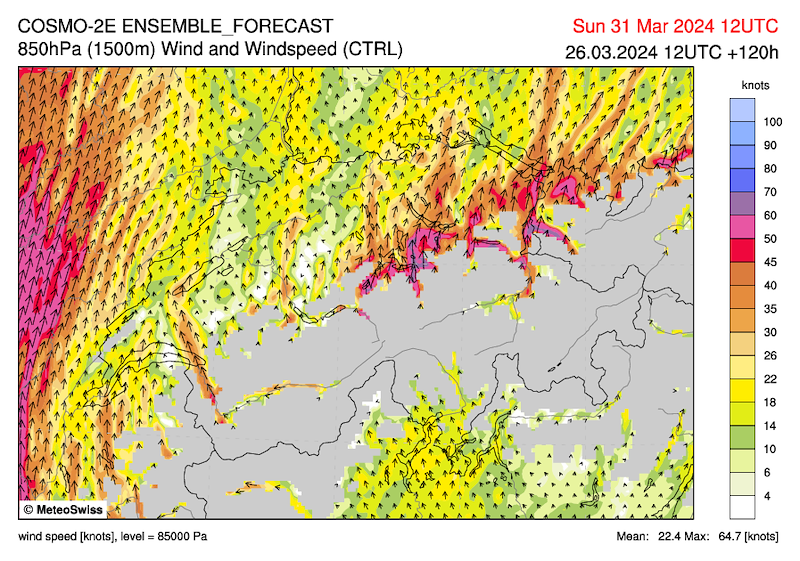
Partial trough that touches us towards evening. Probably quite sunny. Strong foehn in the Alps. Clouds and some showers on the main Alpine ridge from the south, some showers possible towards evening, especially in the Jura.
Decrease in temperature at 3000m: Very unstable, which favours thermals but leads to rapid cloud formation with possible precipitation.
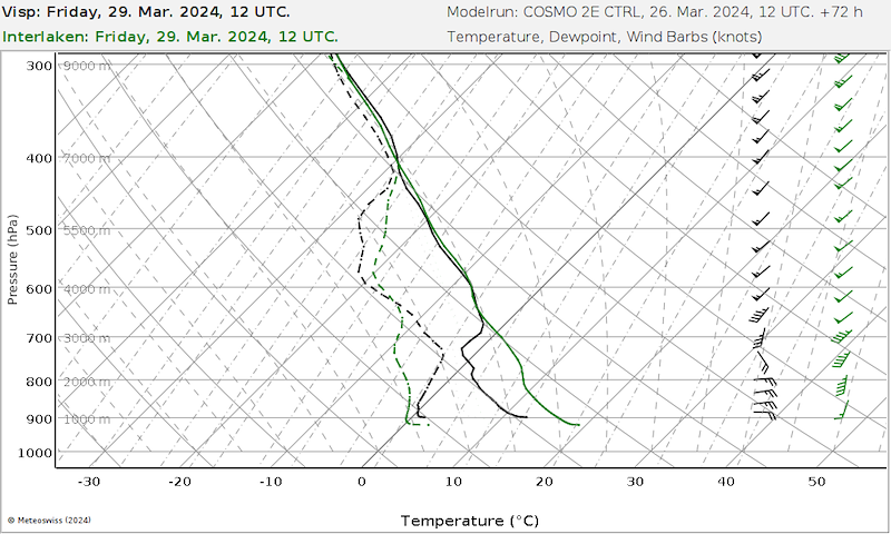
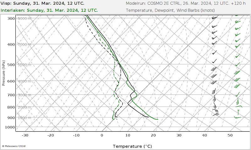
Interlaken: Up to 2000m little wind, 3000m 40-50 kmh from the south. Possibly clouds from the south.
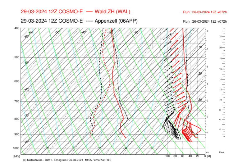
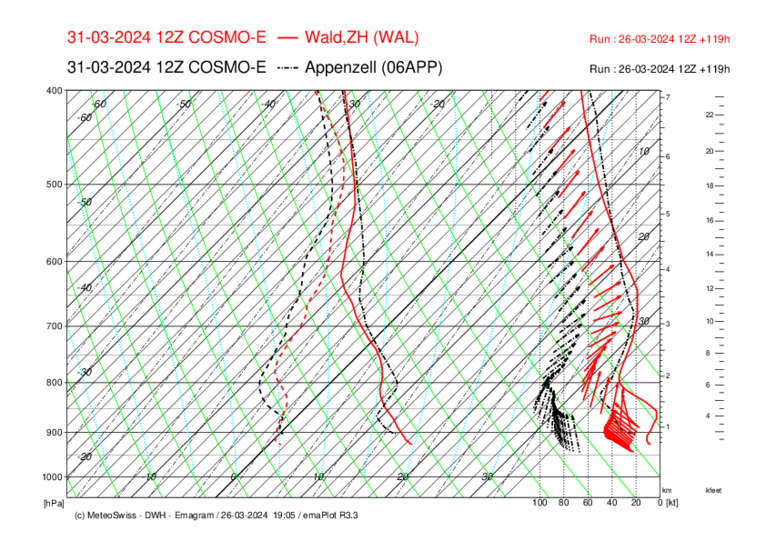
Jura: Weak north wind at the bottom, 30 km/h south at 2000 metres. The problem is the cloud cover at 4000m.
Alp Schgeidegg: There also seems to be too much wind at the moment.
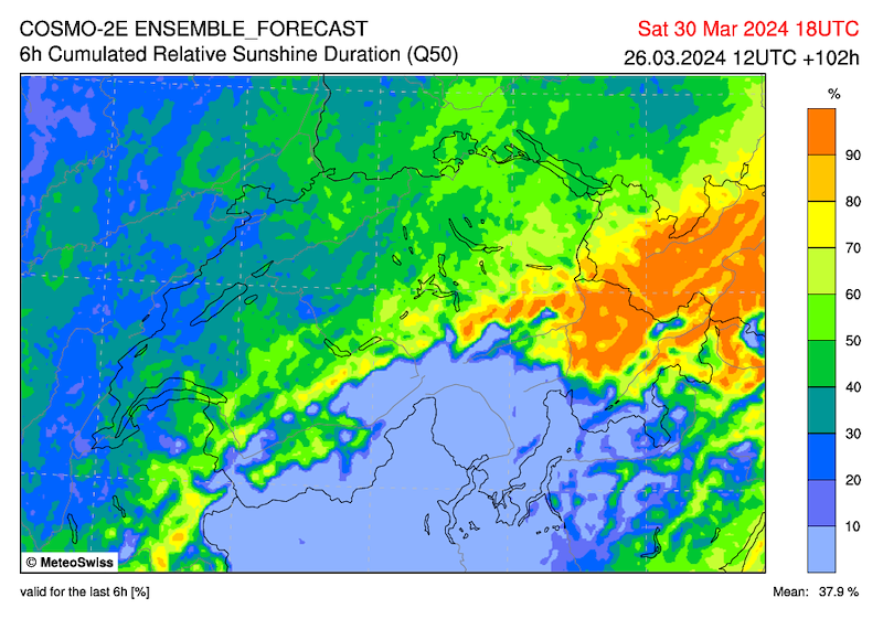
SUNDAY
Probably quite sunny. Foehn in the Alps. Clouds and some precipitation on the main Alpine ridge from the south.
Perhaps it can be said: Foehn or clouds and precipitation.
But it's too early to decide for a task.
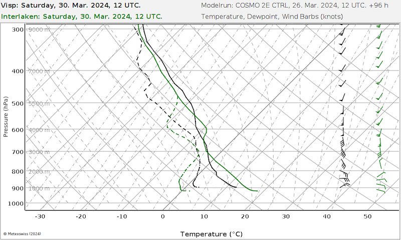
Interlaken: Very good thermals up to 2500m, possibly some precipitation due to the rapid cloud formation. Wind: Up to 2000m little wind, 3000m 30 kmh from the south.
Jura: Initially cloudy with possibly some precipitation. Wind: 1000m 10 kmh, 1500m 25 kmh, 2000m 35 kmh from the south.
Alp Scheidegg: The Föhn wind will pick up again.
MONDAY
Foehn decreasing and increasing cloud cover and precipitation with the next front during the course of the day.
****************************
****************************
Das Wetter an Ostern ist schwierig. Grundsätzlich herrscht bis Sonntag Abend (zum teil starker) Föhn mit bis zu 13 hp, was viele Fluggebiete ausschiesst. Genauer hinschauen müssen wir für den Jura, Interlaken und Alp Scheidegg (Zürcher Oberland).
Es ist Ostern und alle haben 4 Tage frei. Wir sind uns dieser Situation bewusst und tendieren auf einen frühen Entscheid, auch wenn sich im Nachhinein herausstellt, dass irgendwo ein Task möglich gewesen wäre. Wir würden auch absagen, wenn in Interlaken oder im Jura ein mässig guter Task möglich wäre. Das heisst im Klartext: Wahrscheinlich wird morgen Mittwoch Abend abgesagt :-(
Nächste Info Mittwoch, 20 Uhr.
FREITAG
Anfangs teils dichtere Wolkenfelder und besonders ganz im Norden etwas Niederschlag möglich. Sonst mit hohen Wolkenfeldern wahrscheinlich recht sonnig. Am Alpenhauptkamm aus Süden stark bewölkt und Niederschlag. In den Alpen starker bis stürmischer Föhn.
Wir sehen keine Chance für einen Task.
SAMSTAG
Teiltrog, der uns gegen Abend streift. Wahrscheinlich recht sonnig. In den Alpen starker Föhn. Am Alpenhauptkamm aus Süden übergreifende Bewölkung und einige Schauer, gegen Abend besonders am Jura einige Schauer möglich.
Temperaturabnahme auf 3000m: Sehr instabil, was die Thermik begünstigt, aber zu schneller Wolkenbildung mit ev. Niederschlag führt.
Interlaken: Bis 2000m wenig Wind, 3000m 40-50 kmh aus südlicher Rrichtung. Ev. Bewölkung aus Süden.
Jura: Unten schwacher Nordwind, auf 2000m 30 kmh Süd. Problem ist die Bewölkung auf 4000m.
Alp Schgeidegg: Aktuell scheint es auch zu viel Wind zu haben.
SONNTAG
Wahrscheinlich recht sonnig. In den Alpen weiterhin Föhn. Am Alpenhauptkamm aus Süden übergreifende Bewölkung und etwas Niederschlag.
Vielleicht kann gesagt werden: Föhn oder Niederschlag.
Es ist aber zu früh, um für einen Task zu entscheiden.
Interlaken: Sehr gute Thermik bis 2500m, wegen der schnellen Wolkenbildung ev. etwas Niederschlag. Wind: Bis 2000m wenig Wind, 3000m 30kmh aus südlicher Richtung.
Jura: Anfangs bewölkt mit ev. etwas Niederschlag. Wind: 1000m 10 kmh, 1500m 25 kmh, 2000m 35 kmh aus südlicher Richtung.
Alp Scheidegg: Der Föhn nimmt wieder zu.
MONTAG
Nachlassender Föhn und im Tagesverlauf mit der nächsten Front Bewölkungszunahme und aufkommender Niederschlag.


New Comment