Weather Outlook - Uncertain and difficult
Die Wetterlage für das kommende Wochenende bleibt sehr unsicher und schwierig einzuschätzen.
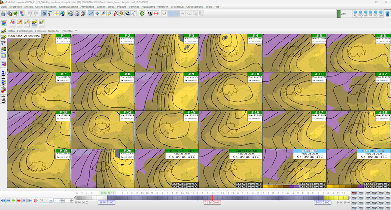
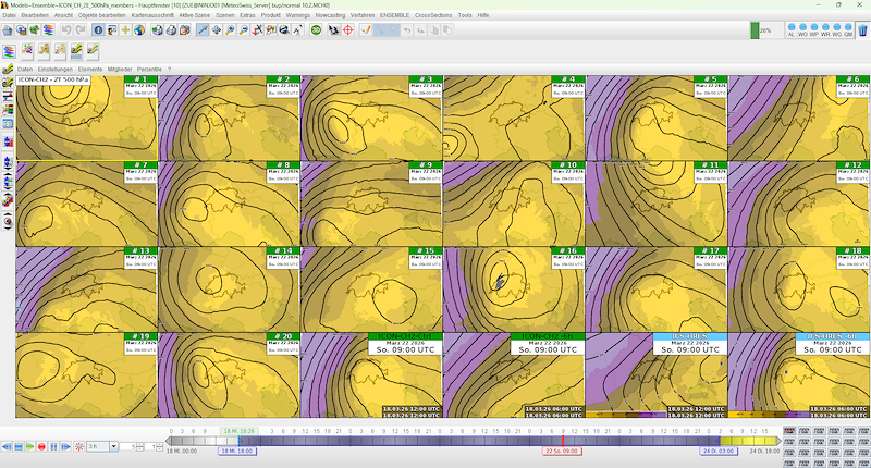
Entscheidend ist die Entwicklung von Höhentiefs am Samstag und Sonntag, welche je nach Verlauf zu deutlich unterschiedlichen Prognosen führen können. Dies macht die Planung aktuell besonders anspruchsvoll.
Allgemeine Lage
Die Schweiz liegt am Südrand eines kräftigen Hochdruckgebietes über Nord- und Osteuropa in einer Bisenströmung. Mit südöstlichen Höhenwinden gelangt meist trockene Luft zu uns.
Bis Freitag stabile und sonnige Bedingungen. Für das Wochenende zeichnet sich jedoch eine unsichere Entwicklung mit zunehmender Bewölkung und möglichem Schauereinfluss ab, insbesondere in den Bergen.
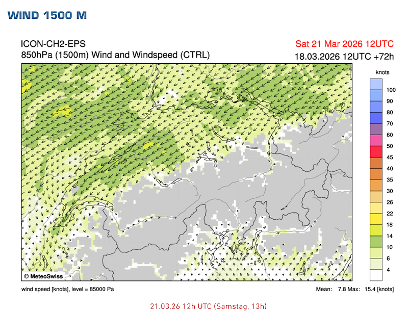
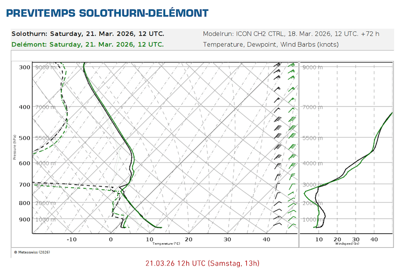
Samstag
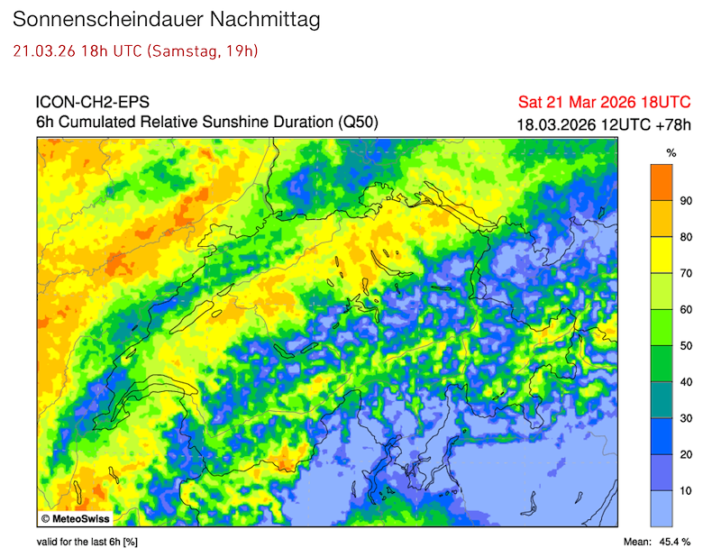
Wahrscheinlich wechselnd bewölkt und nur teilweise sonnig. Im Tagesverlauf sind gebietsweise Schauer möglich, besonders am Nachmittag und in den Bergen. Schneefallgrenze um etwa 1100–1200 m.
Temperaturen um 11–14 °C im Flachland, dazu schwache bis mässige Bise.
Die Thermik dürfte bei Auflockerungen phasenweise möglich sein, insgesamt aber unzuverlässig und durch Abschattung gestört, mit eher moderater Basis.
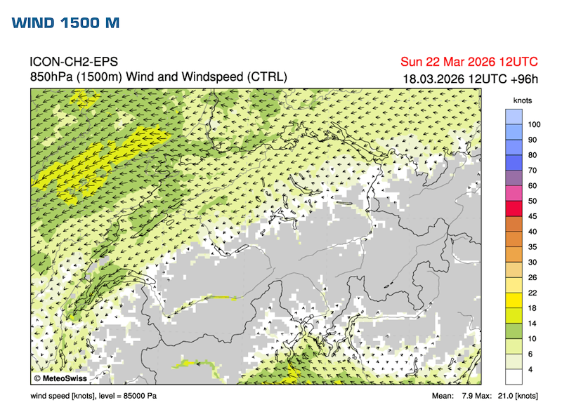
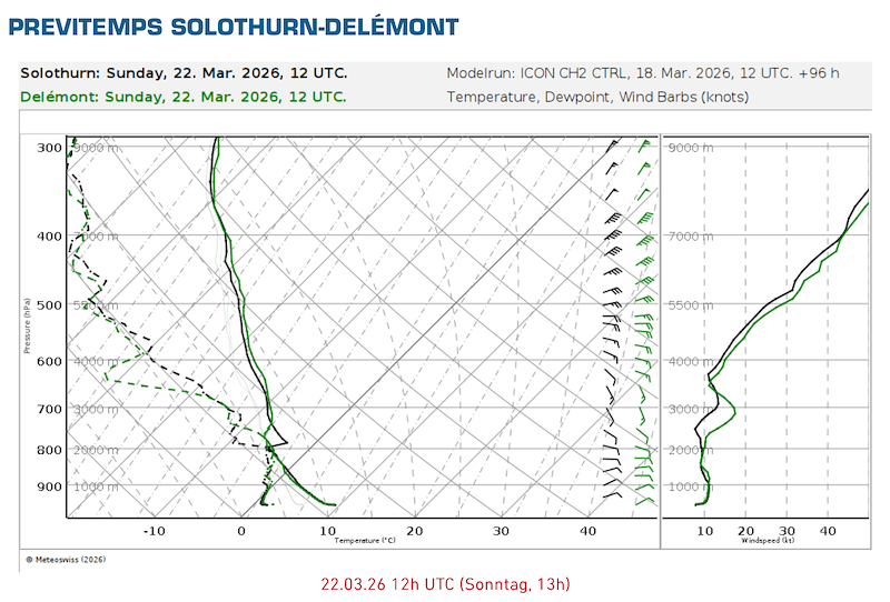
Sonntag
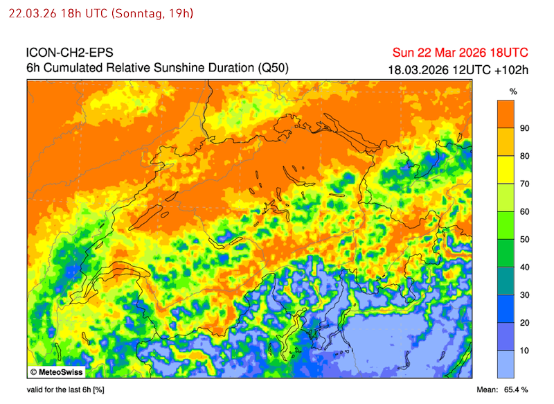
Unsichere Entwicklung. Wahrscheinlich zunächst eher bewölkt mit möglichen Restschauern, im Tagesverlauf Übergang zu teilweise sonnigen Bedingungen.
Temperaturen um 10–13 °C, weiterhin schwache bis mässige Bise.
Thermik grundsätzlich möglich, jedoch stark abhängig von der Bewölkungsentwicklung. Insgesamt leicht besseres Potenzial als am Samstag, bleibt aber unsicher.
Aktuelle Tendenz
Die Situation ist stark modellabhängig. Aktuell scheint es wahrscheinlich, dass wenn überhaupt nur ein Tag für einen Task in Frage kommt, eher der Sonntag.
Nach heutigem Stand könnte der Samstag im Wallis lokal funktionieren, während der Sonntag dort wieder eingeschränkt sein könnte.
Wir melden uns morgen mit einem Update, hoffentlich mit genaueren Informationen.
*** English ***
The weather situation for the upcoming weekend remains very uncertain and difficult to assess.
A key factor is the development of upper-level lows on both Saturday and Sunday, which may lead to significantly different forecast scenarios depending on their exact track. This makes planning currently quite challenging.
General Situation
Switzerland is located on the southern edge of a strong high-pressure system over Northern and Eastern Europe, resulting in a bise flow. With southeasterly winds aloft, mostly dry air is being advected into the region.
Stable and sunny conditions are expected until Friday. For the weekend, however, a more uncertain development is expected, with increasing cloud cover and a potential for showers, especially in the mountains.
Saturday
Likely partly cloudy with variable cloud cover and only limited sunshine. Showers are possible during the day, especially in the afternoon and in the mountains. Snow line around 1100–1200 m.
Temperatures around 11–14 °C in the lowlands, with a weak to moderate bise.
Thermal activity may be possible during sunny periods, but overall conditions are expected to be inconsistent and affected by cloud shading, with a rather moderate cloud base.
Sunday
Uncertain development. Likely rather cloudy at first with possible residual showers, followed by partial clearing during the day.
Temperatures around 10–13 °C, with continued weak to moderate bise.
Thermal development is generally possible but highly dependent on cloud cover. Overall slightly better potential than Saturday, but still uncertain.
Current Trend
The situation remains highly model-dependent. At the moment, it appears that if any task is possible, it would more likely be on Sunday.
Based on current data, Saturday could locally work in the Valais, while Sunday there may again become more restricted.
We will provide another update tomorrow, hopefully with more precise information.


New Comment