Weather report and Info Thuesday
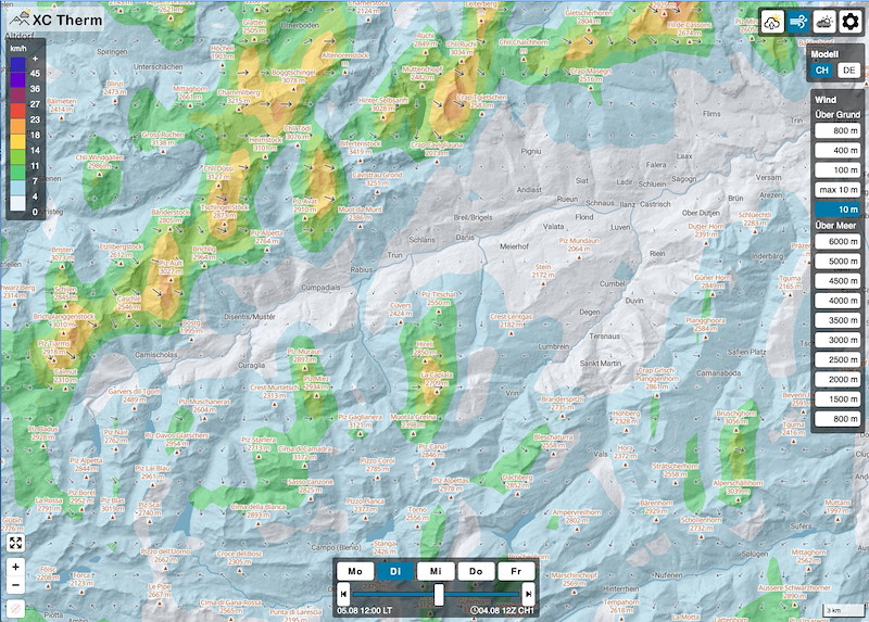
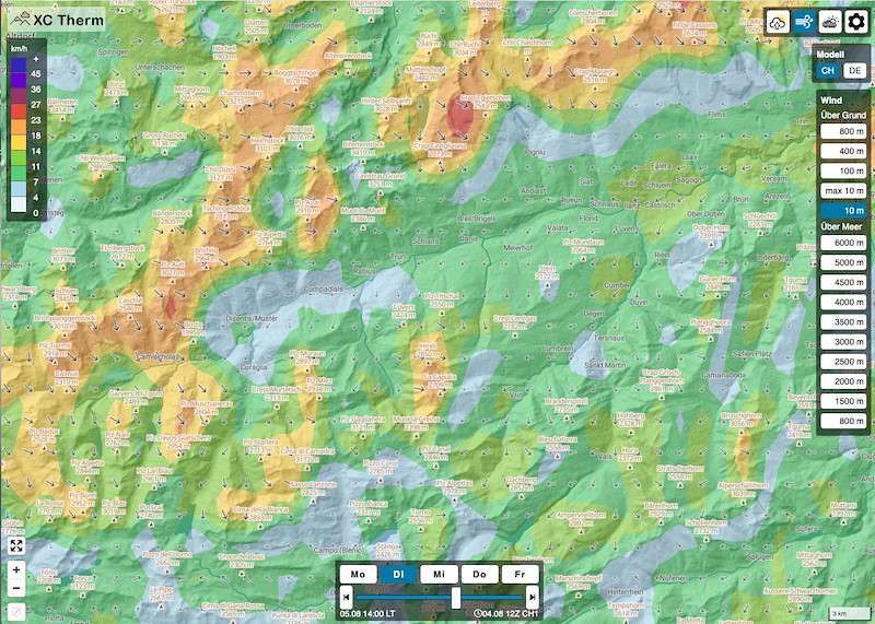
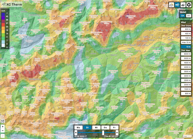
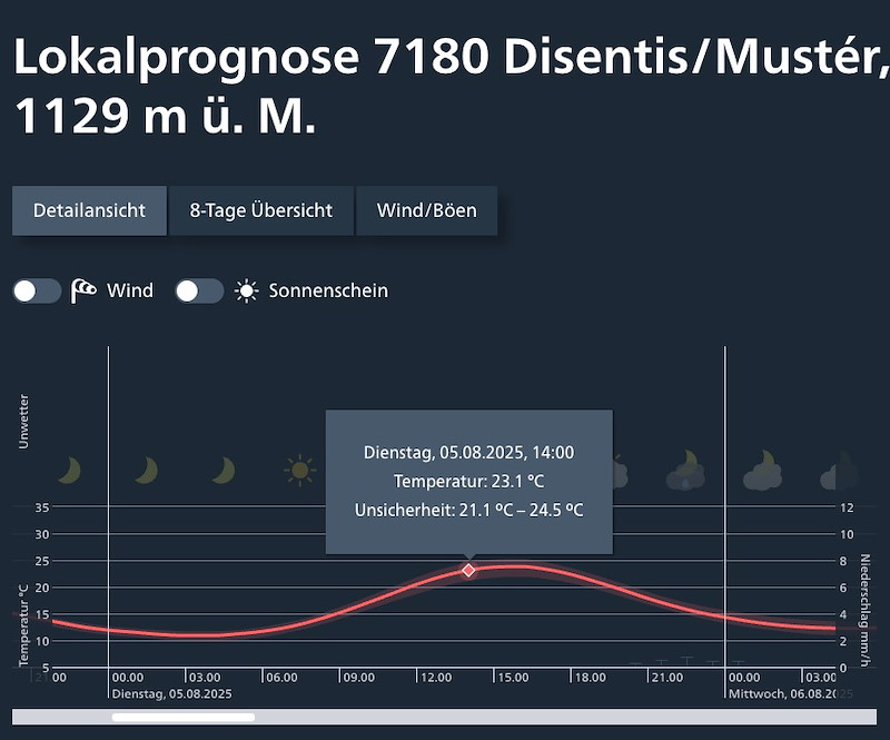
The forecast for Tuesday has improved further. However, We expect dense clouds in the morning until around noon, followed by strong winds from midday onwards, which means we will have to start early and on weak conditions.
Tuesday:
7.30 - 8 Uhr Late Registration HQ (no late registration possible !!)
9:00 first Gondola
9:45 Uhr Briefing Middle Station Caischavedra
11:00 Uhr Window Open
METEO
DIENSTAG
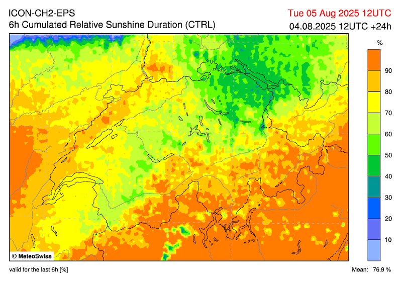
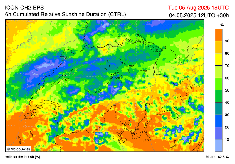
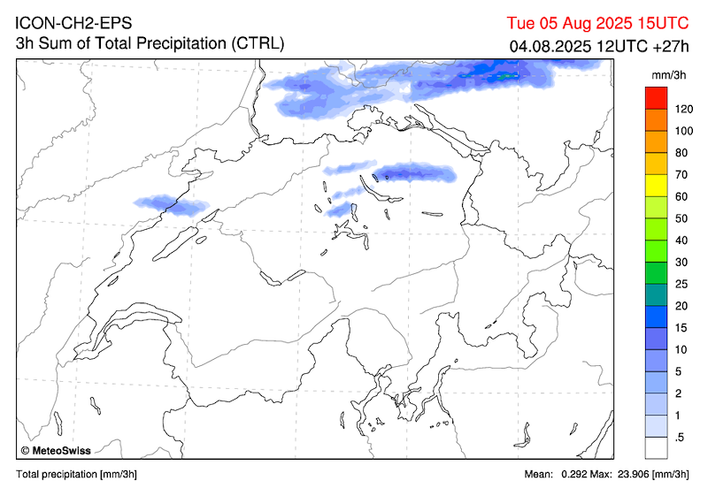
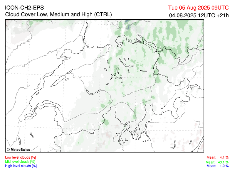
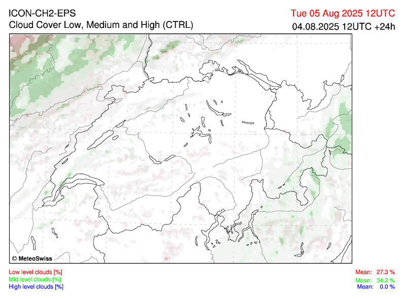
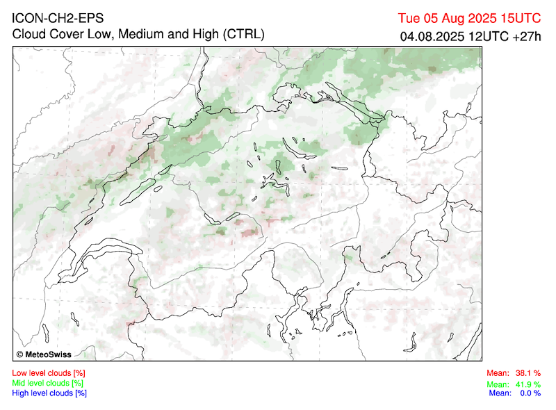
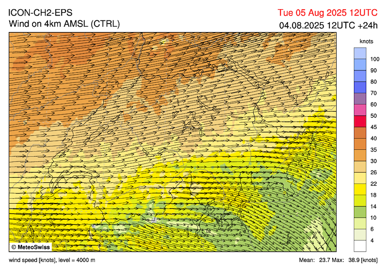
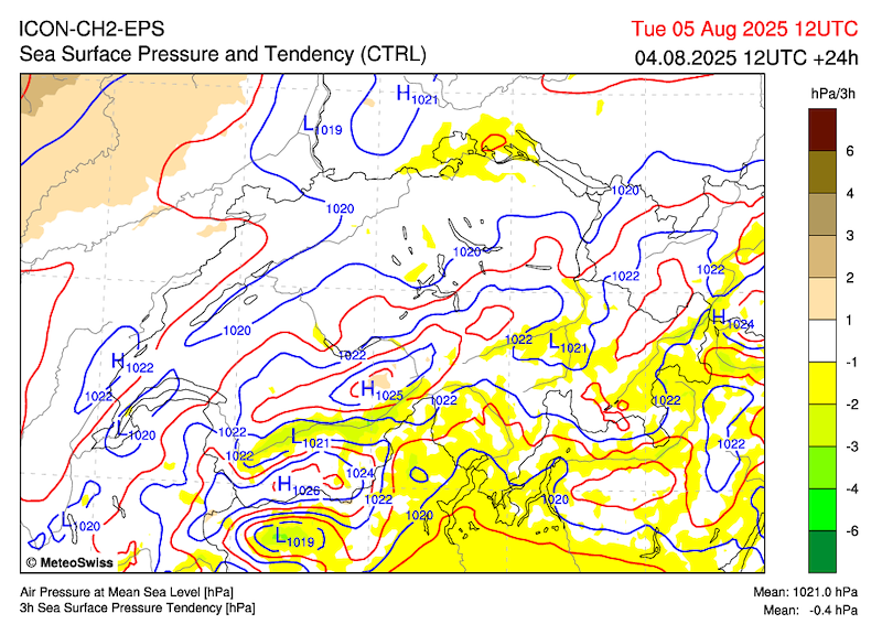
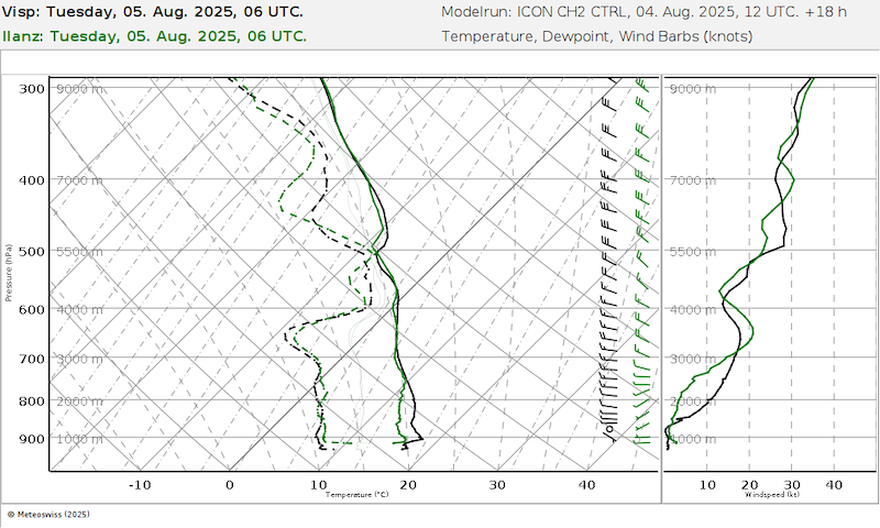
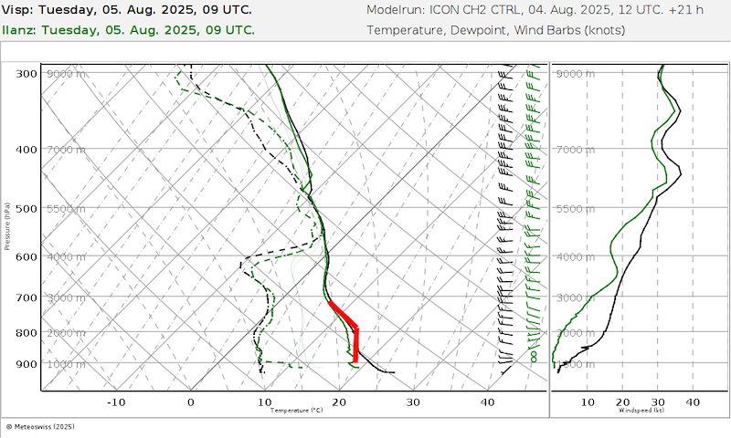
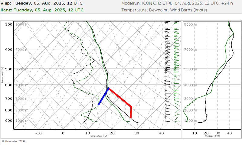
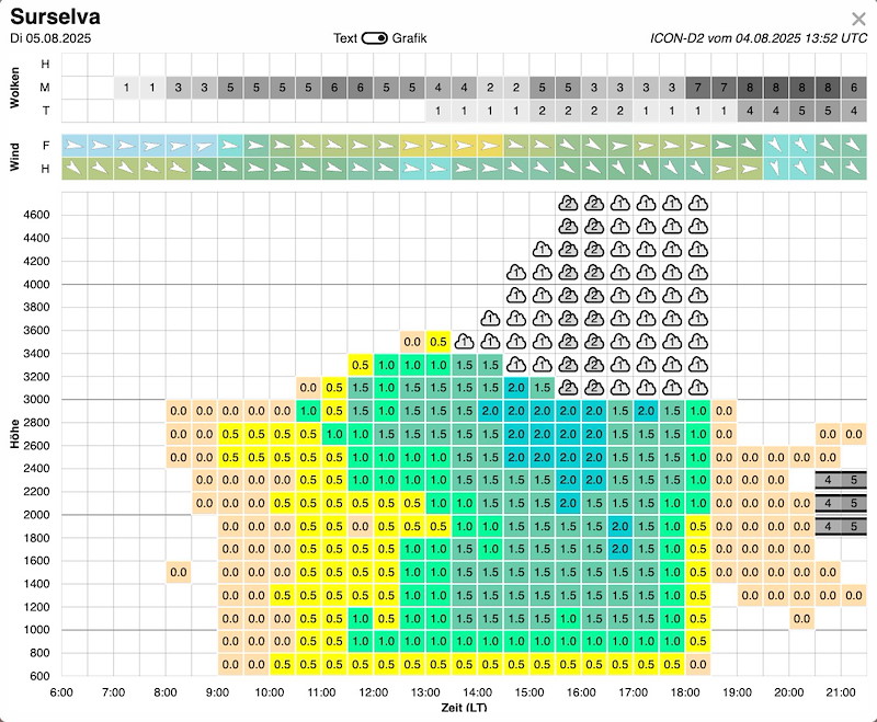
In the morning, a zone of medium-high clouds (9-12) will pass through, giving way to sunny weather from midday onwards. A weak cold front will brush the north of Switzerland (in the Glarus region between 4 and 8 p.m.), but we will remain largely unaffected.
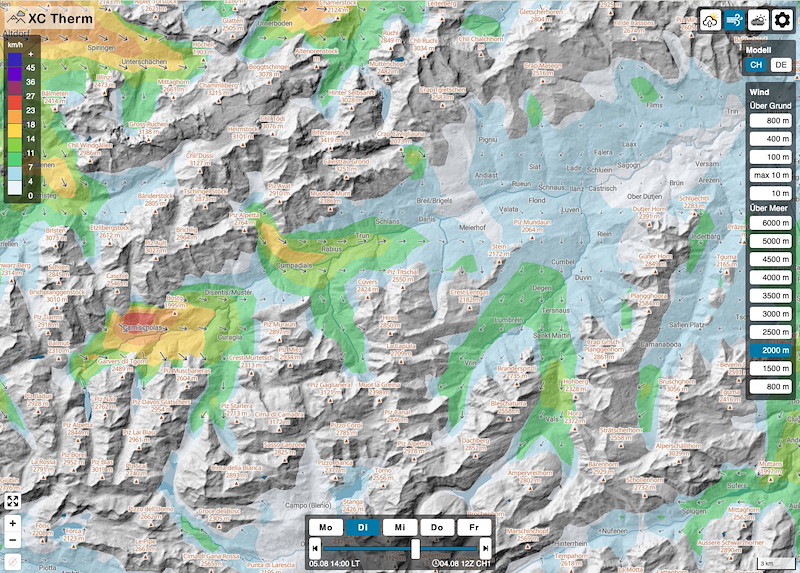
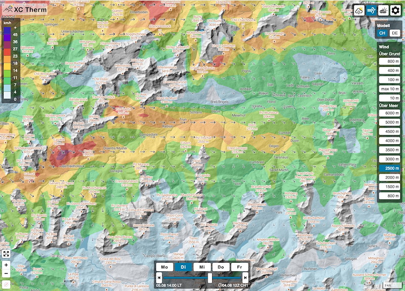
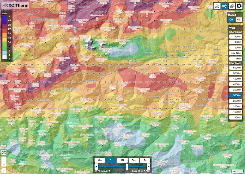
Moderate thermals developing, 1/8 Cu with base at 12:00 3000 and later higher (according to calculations 3500).
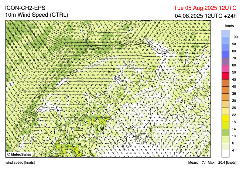
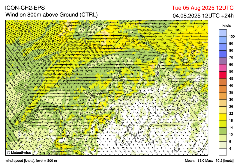
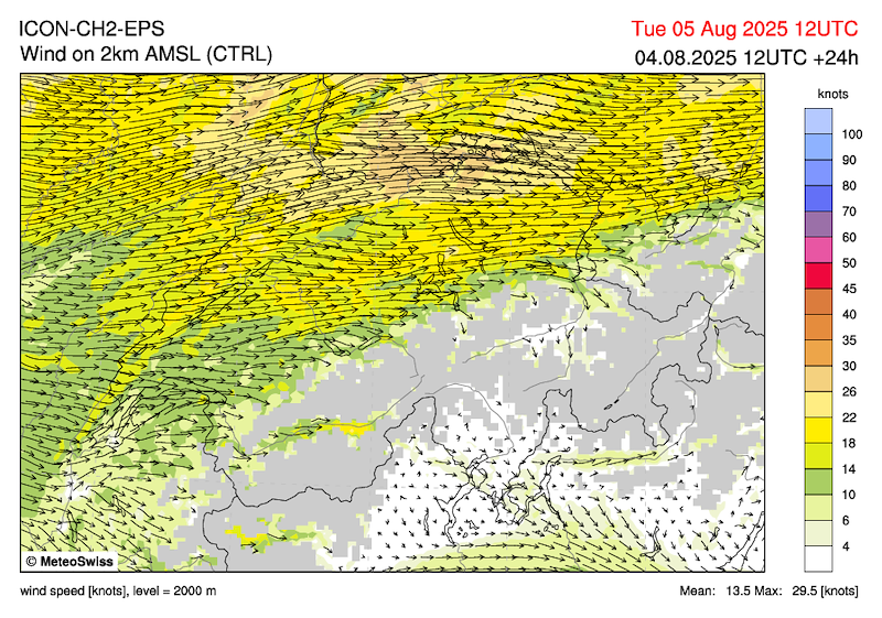
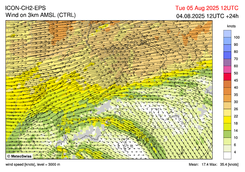
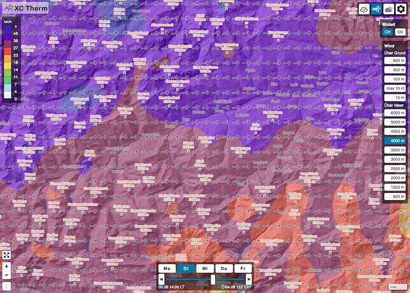
Wind:
Increasing from midday, forecast for 2 p.m.:
Ground valley wind
(1500 m Disentis from 2:30 p.m. strong N!)
2000m west, northwest, 15 km/h
2500m northwest, 20-25 km/h
3000m west, 25 km/h
3500m west, 35-40 km/h
4000m west, 40 km/h
We have to start very early and finish the task by 3 p.m.
WEDNESDAY
Lots of residual cloud in the morning, quickly dissolving and transitioning to flying weather. Warm air advection and lots of cirrus clouds, even medium-high clouds. In the afternoon, weak to moderate thermals.
Thursday morning with some residual cloud, turning into cumulus clouds.
Friday friendly, good thermals, SW conditions
Saturday afternoon with possible showers


New Comment