OGO: Info and meteo sunday, update 7:40
Briefing 10:00
Meteo
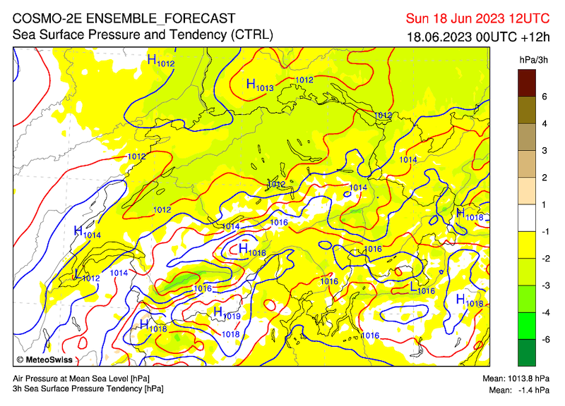
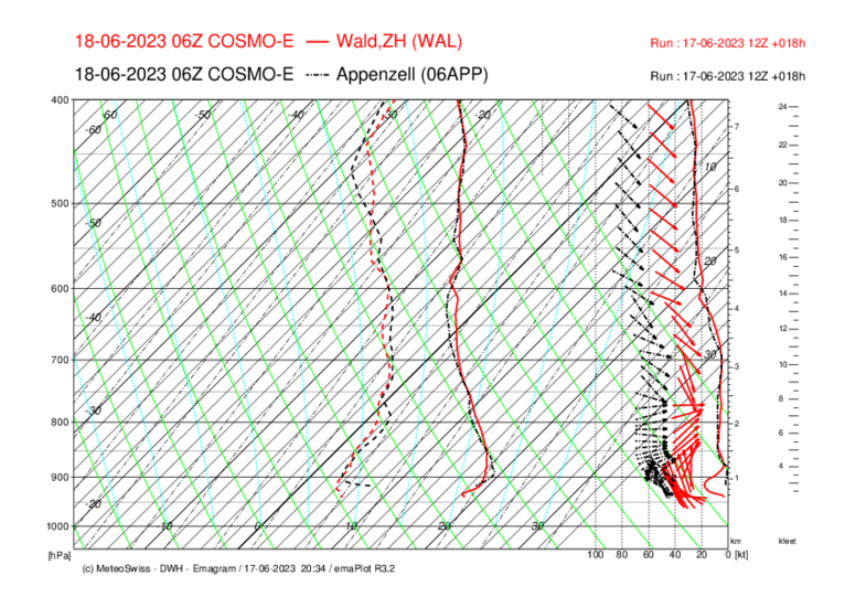
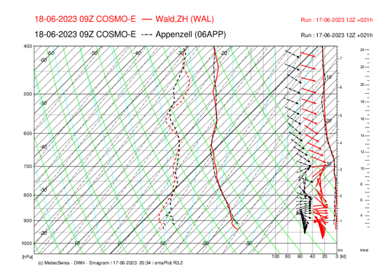
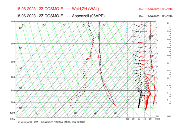
With a southwesterly high-altitude current, very warm and in the second half of the day increasingly humid air will reach Switzerland today.
South overpressure rising to 4 hp
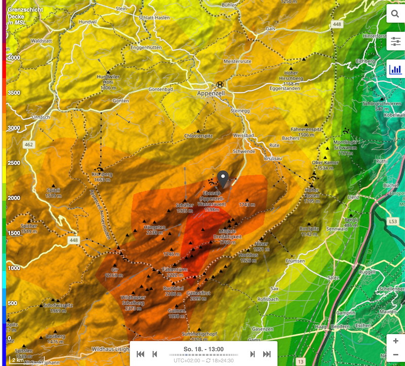
Zero degree limit 380 0m
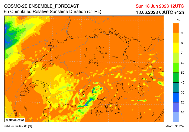
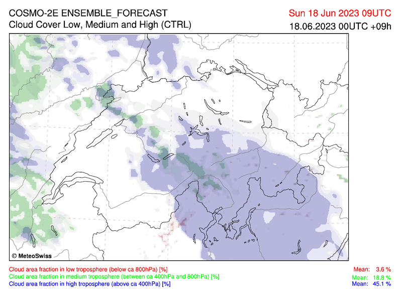
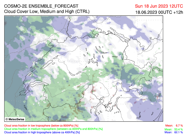
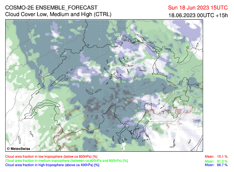
In the morning clear, later weak cirrus clouds. Top 2400 m to 3000 m, in the afternoon 1-2/8 Cu.
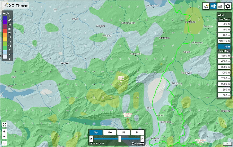
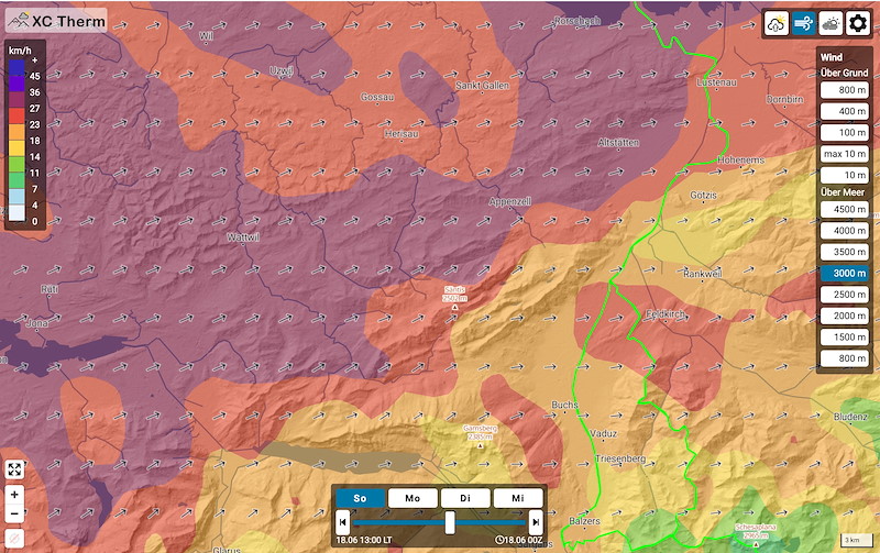
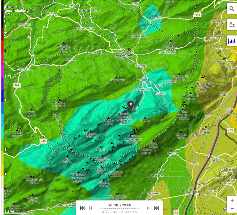
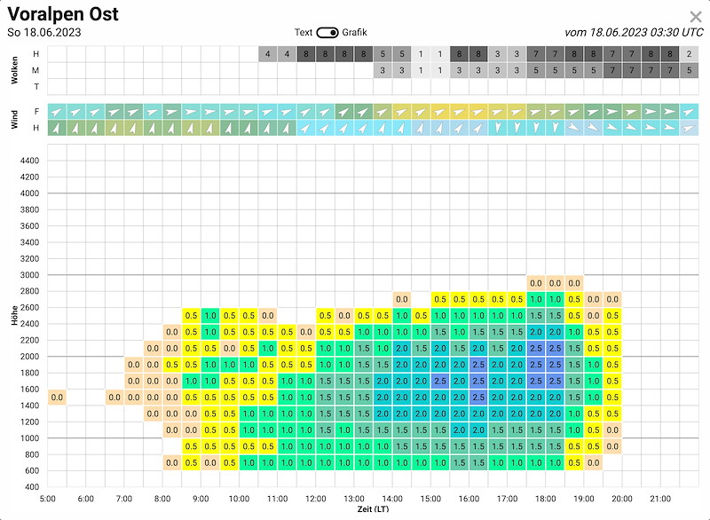
Thermals:
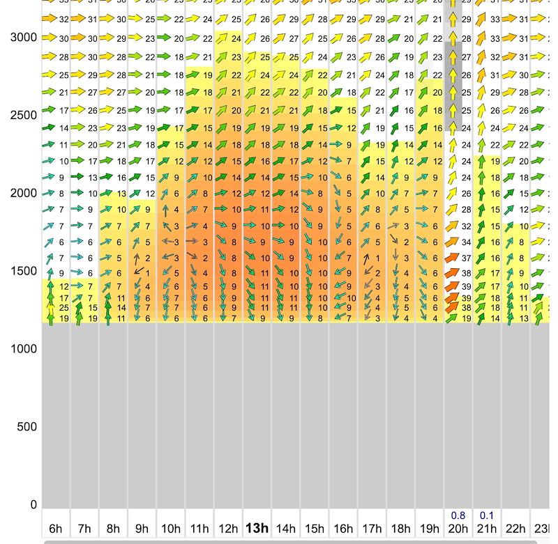
Moderate - good from noon, reducing from 2 or 3 pm.
Pronounced morning inversion up to 1000m. Warm air advection 2°
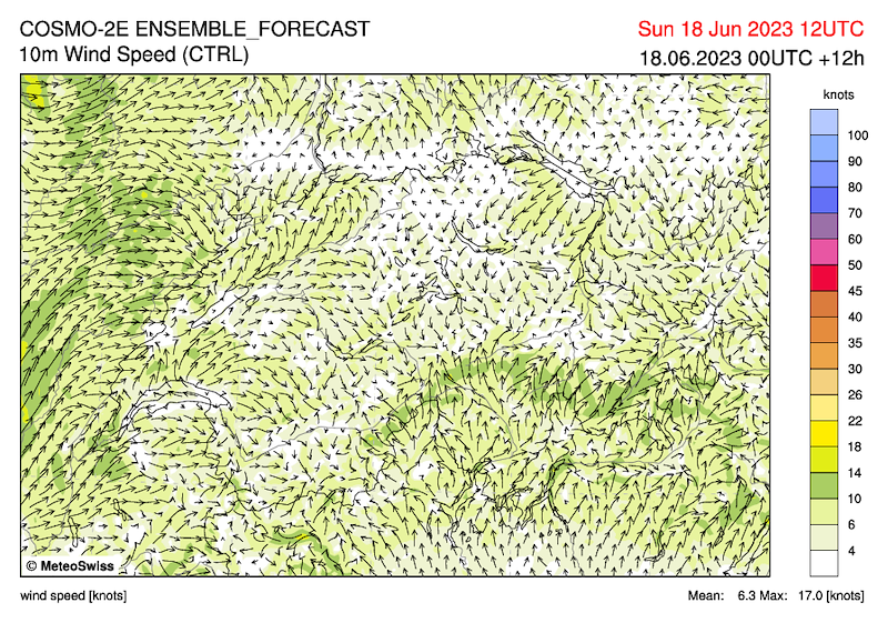
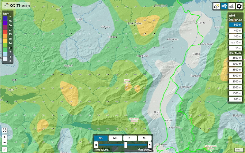
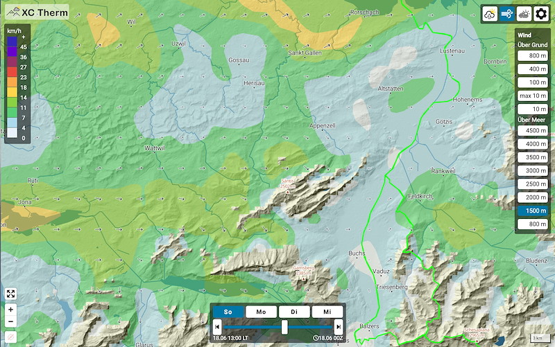
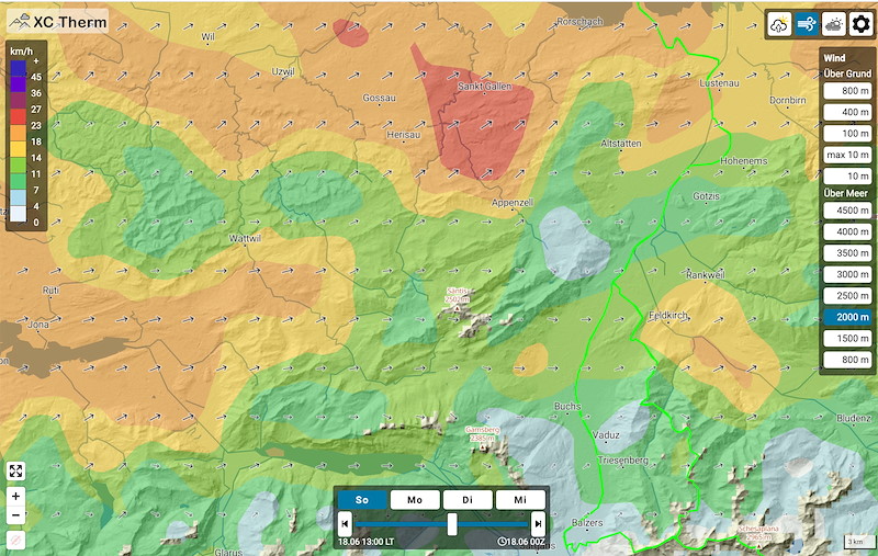
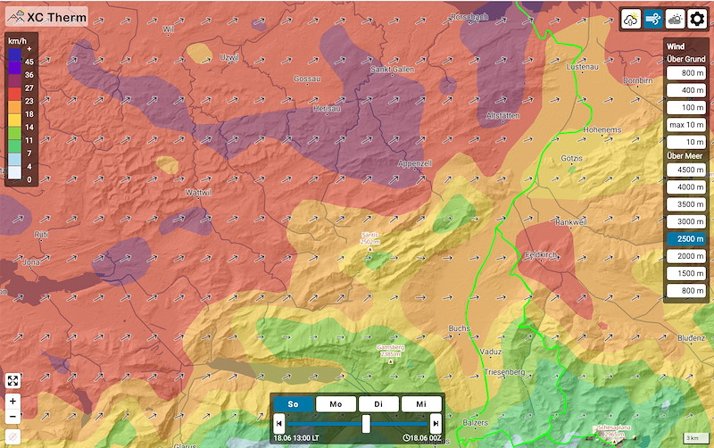
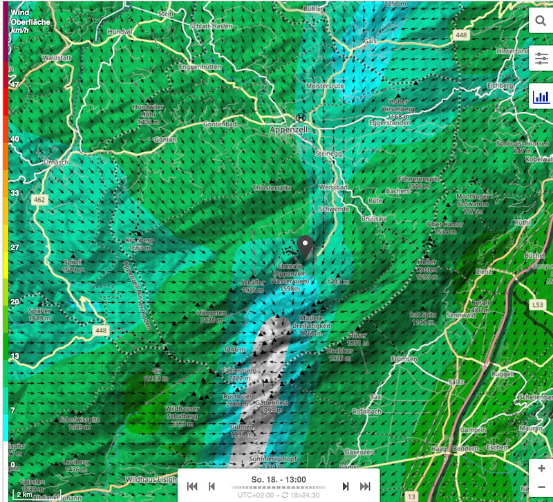
Wind 14:00 (before less, after more):
Ground: Valley winds from N or NE, 10 kmh
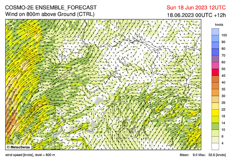
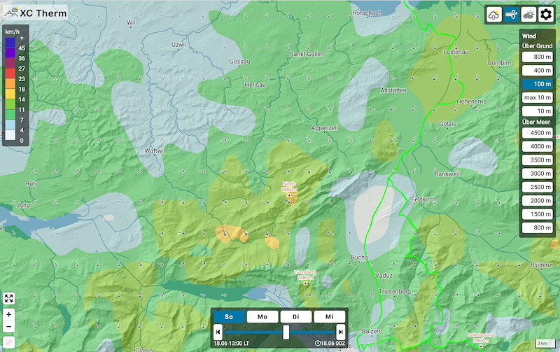
1500 m thermal wind directions and strength, tendency N
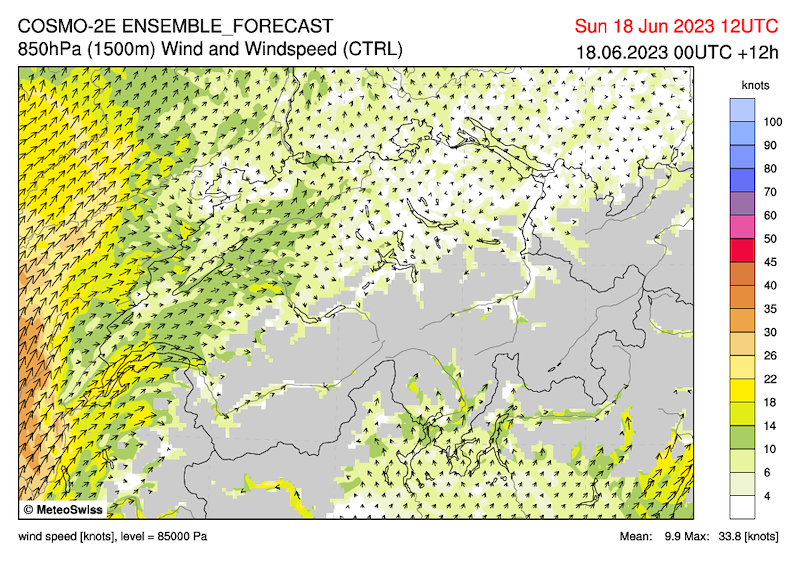
2000 m 15-20 SW
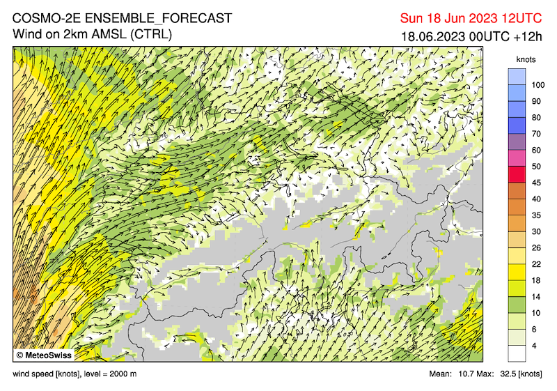
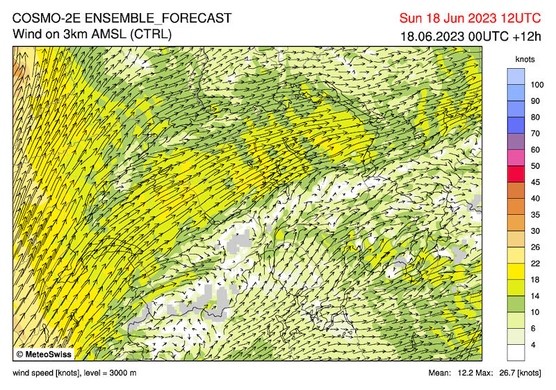
3000 m 25-35 kmh SW
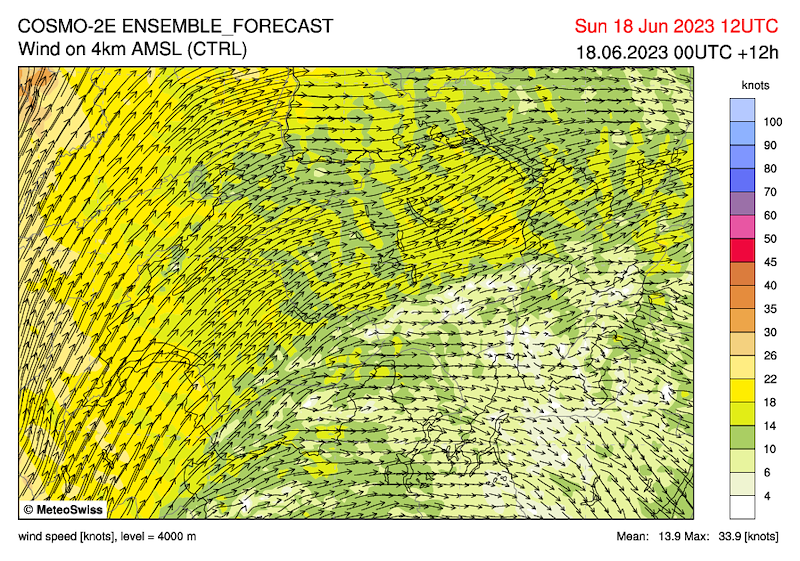
4000 m 35-45 kmh SW
Due to the weak northerly wind up above the height of the hills and the inversion up to 1000m, I expect little turbulent thermals up to 1800m (difficult to find though?) and quite good flying conditions. Above that, the southwest wind will disturb. Possibly the south-westerly will penetrate further down in places (according to the forecasts this is not the case, but possibly behind the Säntis?).
************************************************************
Mit einer suedwestlichen Hoehenstroemung gelangt heute Sonntag sehr warme und in der zweiten Tageshaelfte auch zunehmend feuchte Luft zur Schweiz.
Südüberdruck auf 4 hp steigend
Nullgradgrenze 3800m
Am Vormittag heiter. Top 2400 m bis 3000 m, am Nachmittag 1-2/8 Cu.
Thermik:
Maessig ab Mittag gut, ab 14 oder 15 Uhr abnehmend.
Ausgeprägte Morgeninversion bis 1000m. Warmlusftadvektion 2°
Wind 14 Uhr. Vorher weniger, nachher stärker:
Boden: Talwinde aus N oder NO, 10 kmh
1500 m thermisch bedingte Windrichtungen und Stärke mit Nord-Tendenz
2000 m 15-20 SW
3000 m 25-35 kmh SW
4000 m 35-45 kmh SW
Wegen dem schwachen Nordwind bis über die Höhe der Hügel und der Inversion bis 1000m erwarte ich bis 1800m wenig turbulente Thermik (allerdings schwierig zu finden?) und recht gute Flugbedingungen. Darüber wird der Südwestwind stören. Ev greift der Südwest stellenweise weiter nach unten durch (nach den Prognosen ist dies nicht der Fall. Aber ev hinter dem Säntis?).


New Comment